
Mona Canyon
Submarine Canyon·Caribbean
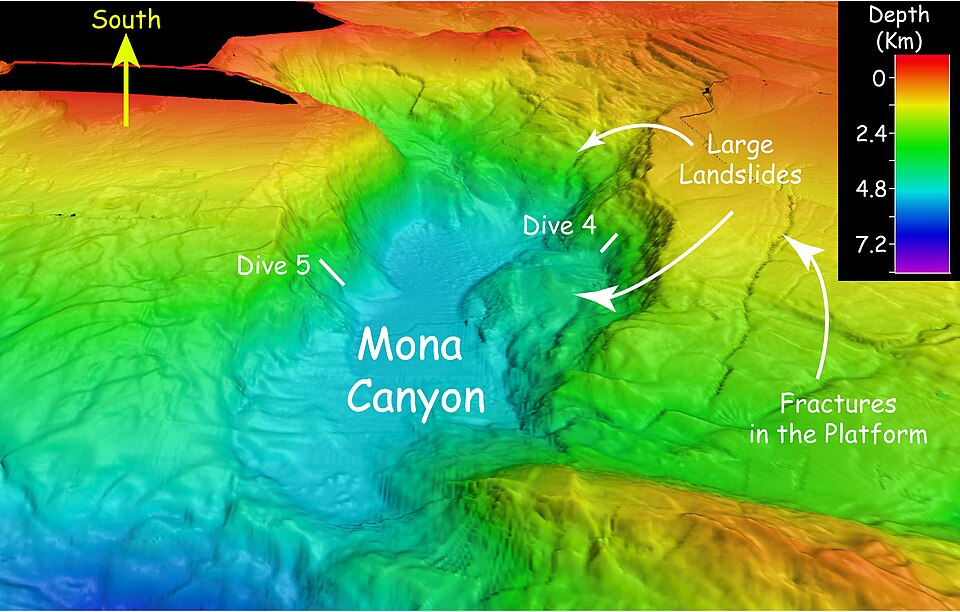
Mona Canyon, also known as the Mona Rift, is a vast submarine canyon situated in the Mona Passage between Hispaniola and Puerto Rico. Stretching 87 miles, its steep walls reach over 2 miles in height, and it plays a significant role in the geologically active region marking the boundary between the Caribbean and North American plates. This canyon is notable for its association with seismic activity, including the epicenter of the 1918 Puerto Rico earthquake.
Key Facts
- ›Located in the Mona Passage between Hispaniola and Puerto Rico.
- ›Approximately 87 miles (140 km) long.
- ›Steep walls range from 1.25 to 2.17 miles (2.01 to 3.49 km) in height.
- ›Stretches from the Desecheo Island platform to the Puerto Rico Trench.
- ›Associated with earthquakes and tsunamis, including the 1918 Puerto Rico earthquake epicenter.
- ›Geomorphology is complex and shaped by tectonic and oceanographic forces.
Cañón de la Mona, Mona Rift
Oceanographic Forces, Tectonic Forces
Desecheo Ridge, Puerto Rico Trench
Cusk Eels, Glass Sponges, Sea Cucumbers, Brittle Stars, Sea Stars, Deep-Sea Corals, Carnivorous Sponges, Umbellula Sp., Abyssopathes Cf. Lyra, Cladorhizid Sponges, Munnopsid Isopods, Squat Lobsters, Tube-Dwelling Anemones, Rhodaliid Siphonophores, Deep-Sea Worms
About Mona Canyon
Mona Canyon, also known by its Spanish name Cañón de la Mona and the moniker Mona Rift, is a significant submarine geological formation located within the Mona Passage. This oceanic trench lies between the islands of Hispaniola, particularly the Dominican Republic, and Puerto Rico. The canyon is extensive, measuring approximately 87 miles (140 km) in length, and is characterized by exceptionally steep walls that rise between 1.25 and 2.17 miles (2.01 to 3.49 km) from its floor to the seafloor above.
Geomorphology and Geology
The geomorphology of Mona Canyon is described as highly complex and largely unexplored. Its intricate seafloor is actively shaped by powerful oceanographic and tectonic forces. The canyon is strategically positioned within a complex and irregular tectonic region that marks the boundary between the Caribbean and North American plates. This area is known for seismic activity, with the Septentrional Fault ending nearby. Explorations, such as those conducted during Expedition EX1811, have revealed varied geology within the canyon. Observations include soft sediments that gradually give way to more rugged rocky outcrops. These rocky sections are sometimes encrusted with iron-manganese and display features that bear resemblance to limestone formations, often appearing as cracked angular rock with relatively fresh surfaces and a contrasting white-tan coloration against darker, encrusted rock.
Biological Significance
Despite its unexplored nature, scientific dives have identified a rich diversity of deep-sea fauna within Mona Canyon. The fauna observed includes sparse fish species, with cusk eels being particularly common. Sponge diversity is notable, with glass sponges being a dominant type. Echinoderms, such as sea cucumbers, brittle stars, and sea stars, are among the most abundant organisms. The canyon also hosts deep-sea corals and various invertebrates, highlighting its importance as a deep-sea habitat. Organisms recorded include specific coral species like Umbellula sp. and Abyssopathes cf. lyra, alongside diverse invertebrates such as Cladorhizid sponges, Munnopsid isopods, squat lobsters, and tube-dwelling anemones.
Seismic Activity
Mona Canyon holds particular significance due to its association with significant seismic events and the subsequent risk of tsunamis. The epicenter of the devastating 1918 Puerto Rico earthquake, which generated a destructive tsunami, was located within this submarine canyon, underscoring its role in the region's geological instability.
Source: Wikipedia ↗
Frequently Asked Questions
Where is Mona Canyon located?
Mona Canyon is situated in the Mona Passage, an oceanic strait located between the islands of Hispaniola (specifically the Dominican Republic) and Puerto Rico.
How large is Mona Canyon?
The canyon is approximately 87 miles (140 km) long, with its steep walls measuring between 1.25 and 2.17 miles (2.01 and 3.49 km) in height from bottom to top.
What are the geological features of Mona Canyon?
Mona Canyon is located in a complex tectonic region at the boundary of the Caribbean and North American plates. Its seafloor features soft sediment transitioning to rocky outcrops, some with features resembling limestone formations, and rocks encrusted with iron-manganese.
What kind of marine life is found in Mona Canyon?
Explorations have identified diverse deep-sea fauna, including cusk eels, glass sponges, echinoderms like sea cucumbers and brittle stars, deep-sea corals, and various invertebrates such as sponges, isopods, and squat lobsters.
Is Mona Canyon associated with seismic events?
Yes, Mona Canyon is particularly associated with earthquakes and subsequent tsunamis. The epicenter of the 1918 Puerto Rico earthquake was located within the submarine canyon.
Related Canyons

Avilés Canyon
The Avilés Canyon is a significant submarine canyon system located off the coast of Asturias, Spain, in the Cantabrian Sea. As part of the larger Avilés Canyon System, it extends for approximately 75 kilometers and plunges to depths of nearly 5 kilometers, positioning it among the deepest on the planet. This deep-sea environment is a recognized biodiversity hotspot, supporting a rich array of marine life, including various whale species, numerous starfish, and ancient cold-water coral reefs.
Bass Canyon
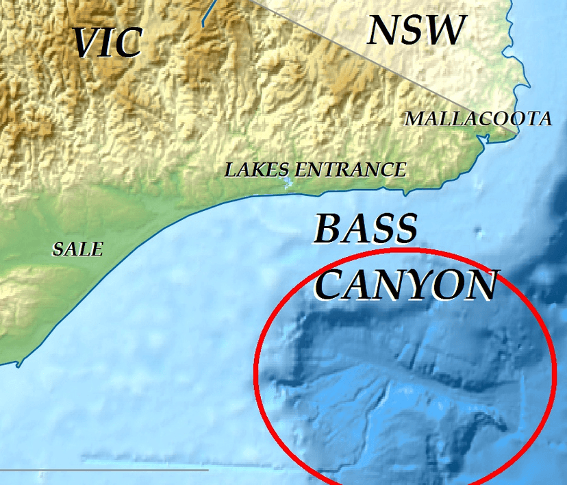
Bass Canyon is a vast submarine canyon system located off the coast of eastern Victoria, Australia, in Bass Strait. It is one of the deepest and largest submarine canyons globally, extending over 160 kilometers and reaching depths exceeding 3,000 meters. Its formation is attributed to complex erosional processes involving sediment gravity flows and tectonic activity, with evidence suggesting it has evolved over millions of years.

Bering Canyon
Bering Canyon is the longest submarine canyon in the Bering Sea, stretching approximately 400 km across the continental shelf and slope. It is bordered by the Aleutian Islands to the east and culminates in a submarine channel-lobe system at the Aleutian Basin. Its immense length gives it the largest area among the Bering Sea canyons, despite being narrower at the shelf break than some others.