
Noatak Canyon
River Canyon·North America·Noatak River
The Noatak Canyon, primarily referring to the watershed of the Noatak River, is a vast and largely undisturbed river system in northwestern Alaska. Its headwaters are in the Brooks Range, and it flows westward for approximately 684 km to the Chukchi Sea. The entire watershed is protected within the Gates of the Arctic National Park and Noatak National Preserve, making it the largest undisturbed watershed in the United States.
Key Facts
- ›The Noatak River flows for approximately 684 km (425 miles).
- ›Its entire course lies north of the Arctic Circle.
- ›The Noatak basin is the largest undisturbed watershed in the United States.
- ›The Noatak National Preserve alone covers 26,000 km2 (6,500,000 acres).
- ›330 miles (530 km) of the Noatak are designated as part of the National Wild and Scenic Rivers System.
- ›The river's headwaters are in the Schwatka Mountains of the Brooks Range.
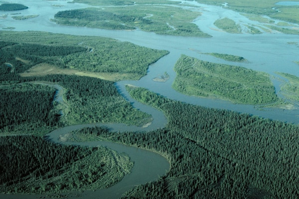
Nuataam Kuuŋa, Noatok, Noatuk, Nunatok, Notoark, Inland River
River Erosion
Braided Rivercourses, Remnant Glaciers In Schwatka Mountains
Nuataam KuuŋA
About Noatak Canyon
The Noatak Canyon primarily refers to the vast watershed of the Noatak River, a significant river system located in the northwestern region of Alaska, United States. The river's headwaters originate on the northern slopes of Mount Igikpak within the Schwatka Mountains of the Brooks Range. From there, it embarks on a westward journey of approximately 684 kilometers (425 miles) before emptying into the Chukchi Sea at Kotzebue Sound. Notably, the entire course of the Noatak River lies north of the Arctic Circle.
Protected Status and Significance
A defining characteristic of the Noatak basin is its exceptional level of preservation. The river's entire watershed is situated within two major protected areas: Gates of the Arctic National Park and the Noatak National Preserve. The Noatak National Preserve alone is an immense area, covering 26,000 square kilometers (6,500,000 acres). This comprehensive protection ensures that the Noatak basin remains the largest undisturbed watershed in the United States, a testament to its ecological integrity.
Naming and Designation
The name "Noatak" is derived from the Inupiaq name "Nuataam Kuuŋa." In 1853, surgeon John Simpson of the Royal Navy mapped the river and referred to it as "Inland River," which is thought to be a general translation of the Inuit name "Nunulak." The term "Nunatak" itself has been interpreted to mean "new land" or "belong to the land." Beyond its natural significance, a substantial portion of the Noatak River, specifically 530 kilometers (330 miles) from its source to the Kelly River within the Noatak National Preserve, was designated as part of the National Wild and Scenic Rivers System on December 2, 1980.
Geography and Settlements
The Noatak River is characterized by its braided rivercourses, a common feature of large Arctic rivers. While there are small remnant glaciers in the Schwatka Mountains, their contribution to the river's water budget is minimal. Rare, severe rain events can lead to temporary, rapid inundations of normally dry river bars. The only permanent settlement situated along the Noatak River is the village of Noatak, which features a public airstrip, several stores, a post office, and a school.
Source: Wikipedia ↗
Frequently Asked Questions
Where is the Noatak Canyon located?
The Noatak Canyon, referring to the Noatak River's watershed, is located in the northwestern part of Alaska, USA. Its course is entirely north of the Arctic Circle.
What is the significance of the Noatak River's watershed?
The Noatak River basin is recognized as the largest undisturbed watershed in the United States. This means it remains largely in its natural state, with minimal human alteration.
What protected areas encompass the Noatak River?
The entire watershed of the Noatak River is located within protected areas. This includes Gates of the Arctic National Park and the Noatak National Preserve, which together delineate the river's watershed from its source to near the village of Noatak.
What does the name 'Noatak' mean?
The name 'Noatak' is an anglicization of the Inuit name 'Nuataam Kuuŋa'. Surgeon John Simpson of the Royal Navy translated the Inuit name 'Nunulak' as 'Inland River' in 1853, with 'Nunatak' potentially also meaning 'new land' or 'belong to the land'.
Is any part of the Noatak River a designated wild and scenic river?
Yes, on December 2, 1980, 330 miles (530 km) of the Noatak River were designated as part of the National Wild and Scenic Rivers System. This section extends from its source in Gates of the Arctic National Park to the Kelly River in the Noatak National Preserve.
Are there any permanent settlements along the Noatak River?
The only permanent settlement along the Noatak River is the village of Noatak. This village is equipped with an airstrip, stores, a post office, and a school.
Related Canyons

Big Bend National Park
Big Bend National Park is a vast protected area in West Texas, notable for its extensive Chihuahuan Desert topography and ecology. Formed by the erosive power of the Rio Grande and significant geological uplift, the park preserves a rich tapestry of life, including over 1,200 plant species and hundreds of animal species, as well as ancient fossils and diverse rock formations. Its remote location and dramatic landscapes, including the Chisos Mountains and deep river canyons, make it a significant destination for naturalists and adventurers.
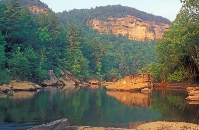
Big South Fork of the Cumberland River
The Big South Fork of the Cumberland River is a significant river system in Tennessee and Kentucky, carved into the Cumberland Plateau. This 76-mile waterway is characterized by rugged terrain with deep gorges, natural arches, and rock shelters, and is the central feature of the Big South Fork National River and Recreation Area. Its formation by river erosion has created a diverse ecosystem and a popular destination for outdoor recreation.

Black Canyon of the Gunnison
The Black Canyon of the Gunnison is a dramatic gorge in western Colorado, carved by the Gunnison River. Its name derives from the fact that its sheer walls receive very little sunlight, often appearing black. The canyon is renowned for its extreme depth, steepness, and narrowness, combining these features into a formidable and awe-inspiring landscape.