
North Stradbroke Island
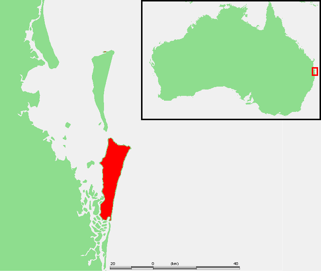
North Stradbroke Island, known to its traditional owners as Minjerribah, is the second-largest sand island globally, situated in Moreton Bay, Queensland, Australia. Formed by natural processes over millennia, it is characterized by its extensive freshwater lakes, wetlands, and diverse coastal ecosystems. The island holds significant cultural importance for the Quandamooka people and is a major tourist destination and site for ongoing sand mining operations.
Key Facts
- ›Second largest sand island in the world.
- ›Approximately 38 km long and 11 km wide, with an area of 275.2 km².
- ›Features over 100 freshwater lakes and wetlands, including Blue Lake and Brown Lake.
- ›Home to a variety of rare and threatened flora and fauna, including migratory wading birds and endemic plant species.
- ›Has a sub-tropical climate with warm, moist summers and MILD winters.
- ›Accessible by vehicular and passenger ferries from Cleveland.
Minjerribah, Straddie, North Straddie
Sand Accumulation, Ocean Currents, Wind Deposition, Hydrological Processes
Blue Lake, Brown Lake, Eighteen Mile Swamp, Point Lookout, Main Beach, Cylinder Beach, Myora Springs, Parabolic High Dunes, Freshwater Wetlands
Migratory Wading Birds, Wallum Froglet, Cooloola Sedge Frog, Oxleyan Pygmy Perch, Water Mouse, Swamp Orchid
Wallum, Notophyll Vine Forest, Mangrove Communities, Paperbark Communities, Freshwater Wetlands Vegetation
Minjerribah, Quandamooka, Goompi, Bulan
About North Stradbroke Island
North Stradbroke Island (Minjerribah)
North Stradbroke Island, known by its traditional owners as Minjerribah, is a significant geographical and cultural landmark located within Moreton Bay, approximately 30 kilometers southeast of Brisbane, Queensland, Australia. It is recognized as the second-largest sand island in the world, boasting a diverse array of natural landscapes, including over 100 freshwater lakes and wetlands, extensive beaches, and rocky outcrops. The island's formation is attributed to the natural processes of sand accumulation and deposition over extended geological periods, shaped by oceanic currents and wind.
Geography and Ecology
The island stretches approximately 38 kilometers in length and 11 kilometers in width, covering an area of 275.2 square kilometers. Its topography ranges up to a maximum elevation of 239 meters. The climate is sub-tropical, characterized by warm, moist summers and mild winters, with an average annual rainfall of 1,587 millimeters. North Stradbroke Island is a vital ecological hub, supporting a rich variety of flora and fauna. Notable habitats include notophyll vine forests on parabolic high dunes and extensive coastal freshwater swamps like the Eighteen Mile Swamp, which is considered one of the largest of its kind globally. The island is also a crucial resting and breeding ground for numerous migratory wading birds.
Lakes and Wetlands
A defining feature of North Stradbroke Island is its abundance of freshwater lakes and wetlands. Among the most significant are Blue Lake, a spring-fed lake protected within Naree Budjong Djara National Park, and Brown Lake, a perched lake known for its unique water retention mechanism. These water bodies are not only geologically interesting but also hold deep cultural significance for the Quandamooka people. Many of these wetlands have persisted since the last ice age, making them valuable for scientific research and conservation efforts. However, some areas, like Lake Kounpee, have been impacted by past sand mining operations.
Flora and Fauna
The island supports a remarkable biodiversity, with 780 plant species recorded, including several classified as threatened or near-threatened. Endemic species such as the underwater spikerush and swamp daisy are found here. The fauna is equally diverse, featuring rare and vulnerable animals like the wallum froglet, cooloola sedge frog, and Oxleyan pygmy perch. Migratory wading birds, listed under international agreements, regularly utilize the island's wetlands.
Human History and Cultural Significance
Archaeological evidence indicates continuous human occupation of North Stradbroke Island since the Pleistocene epoch. The Quandamooka people, descendants of the Nunukal, Goenpul, and Ngugi tribes, are the traditional custodians and have a profound connection to the land, which they refer to as Minjerribah. Their traditional practices, including fishing and hunting, are deeply interwoven with the island's natural resources. The island served as a meeting place and a site for traditional ceremonies. In 2011, the Quandamooka people achieved a significant victory with the Federal Court's determination recognizing their native title rights and interests over the island and surrounding waters.
European exploration began with Matthew Flinders in 1802. The island later saw the establishment of a maritime pilot station at Amity in 1825 and a British outpost at Dunwich in 1827, which evolved into a quarantine station and later a benevolent asylum. Aboriginal people were historically displaced and, at times, segregated. Despite historical challenges, the island is now a popular tourist destination, with tourism and sand mining being its primary industries. The joint management of Naree Budjong Djara National Park by the Quandamooka people and the Queensland State government highlights a commitment to preserving the island's natural and cultural heritage.
Source: Wikipedia ↗
Frequently Asked Questions
What is North Stradbroke Island known for?
North Stradbroke Island is renowned for being the second-largest sand island in the world, its numerous freshwater lakes and wetlands, and its significant cultural heritage as the traditional home of the Quandamooka people. It is also a popular destination for tourism, offering beaches, surfing, and natural beauty.
What geological processes formed North Stradbroke Island?
As a sand island, North Stradbroke Island was primarily formed by the accumulation and shaping of sand deposits over vast periods, influenced by ocean currents and wind. Its present-day features, such as the lakes and wetlands, are a result of ongoing hydrological processes and the unique geological structure of the sand mass.
What are the main attractions on North Stradbroke Island?
Key attractions include its pristine beaches like Main Beach and Cylinder Beach, ideal for surfing and swimming. Visitors also frequent the island's freshwater lakes, such as Blue Lake and Brown Lake, and explore the unique wetland ecosystems. Point Lookout is a popular spot for whale watching and enjoying panoramic views.
How can I get to North Stradbroke Island?
North Stradbroke Island is accessible via vehicular and passenger ferries departing from Cleveland, on the mainland near Brisbane. These ferries transport visitors and their vehicles to the island, primarily docking at Dunwich.
What is the significance of the lakes on North Stradbroke Island?
The island boasts over 100 freshwater lakes and wetlands, many of which are perched lakes that retain water due to a layer of organic matter on their floor. Blue Lake is particularly significant as a spring-fed lake and a cultural site for the Quandamooka people, serving as a climate refuge for freshwater biota.
What kind of wildlife can be found on North Stradbroke Island?
North Stradbroke Island is home to a diverse range of fauna, including migratory wading birds, wallum froglets, cooloola sedge frogs, and the Oxleyan pygmy perch. Its unique ecosystems also support various other rare, vulnerable, and endangered species.
Related Canyons

Capertee Valley
Capertee Valley, located in New South Wales, Australia, is recognized as the world's widest canyon, surpassing even the Grand Canyon in its breadth. Carved by the Capertee River over millions of years through Permian and Triassic sedimentary rocks, the valley features dramatic sandstone cliffs and limestone formations. It holds significant ecological importance as a prime breeding site for endangered bird species and is a popular destination for birdwatching and bushwalking.
Carnarvon Gorge
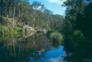
Carnarvon Gorge, located in Central Queensland, Australia, is a significant natural attraction carved primarily by water erosion. Stretching approximately 30 kilometers in length and reaching depths of up to 600 meters, it is renowned for its diverse ecosystems, Indigenous cultural sites, and dramatic sandstone landscapes. As the most visited feature within Carnarvon National Park, it draws over 70,000 visitors annually, offering a unique oasis in a semi-arid region.
Murchison River Gorge
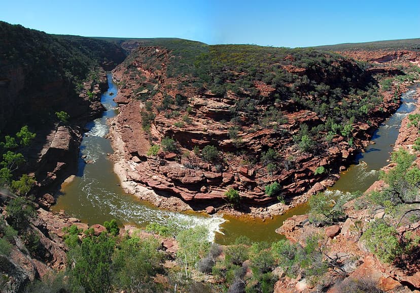
Murchison River Gorge is a significant riverine gorge located in the Mid West region of Western Australia, carved by the lower reaches of the Murchison River. Extending over 80 kilometers and reaching depths of up to 129 meters, it is renowned for its natural beauty and geological importance. The gorge is a major tourist attraction and contains important paleontological evidence of early land animals.