
Pine Creek Gorge
River Canyon·North America·Pine Creek
Pine Creek Gorge, also known as the Grand Canyon of Pennsylvania, is a significant gorge carved into the Allegheny Plateau by Pine Creek in north-central Pennsylvania. Its formation began approximately 20,000 years ago due to glacial activity, which dammed the creek and caused it to flood south, carving a deep channel. The gorge is renowned for its scenic beauty, geological value, and ecological significance, featuring protected areas and recreational trails.
Key Facts
- ›The gorge is 47 miles (76 km) long and carved into the Allegheny Plateau.
- ›Its deepest point is 1,450 feet (440 M) at Waterville.
- ›At Leonard Harrison and Colton Point State Parks, it is over 800 feet (240 M) deep with a rim-to-rim width of about 4,000 feet (1,200 M).
- ›It is situated within approximately 160,000 acres (650 km2) of the Tioga State Forest.
- ›Recreational opportunities include the West Rim Trail for hiking and the Pine Creek Rail Trail for biking.
- ›The gorge was designated a National Natural Landmark by the National Park Service for its superlative scenery and geological value.

The Grand Canyon of Pennsylvania
River Erosion, Glacial Activity
Colton Point State Park Overlooks, Leonard Harrison State Park Overlooks, West Rim Trail, Pine Creek Rail Trail, Allegheny Plateau Carving
White-Tailed Deer, Beaver, Turkeys, Black Bears, River Otters, Bald Eagles
Regrown Forests, Blueberries, Blackberries, Mountain Laurel
About Pine Creek Gorge
Pine Creek Gorge: The Grand Canyon of Pennsylvania
Pine Creek Gorge, often referred to as the "Grand Canyon of Pennsylvania," is a dramatic geological feature located in north-central Pennsylvania. Carved into the Allegheny Plateau by the persistent flow of Pine Creek, the gorge spans approximately 47 miles (76 km) and is a prominent part of the Tioga State Forest landscape.
Formation and Geology
The gorge's dramatic formation is attributed to glacial activity that occurred around 20,000 years ago. At that time, the Laurentide Continental Glacier advanced and deposited a substantial dam of rocks and debris across Pine Creek. This glacial dam created a large lake near present-day Ansonia. When the lake eventually overflowed its dam, the resulting floodwaters carved a deep and imposing channel as the creek surged southward toward the West Branch Susquehanna River.
The deepest point of Pine Creek Gorge reaches an impressive 1,450 feet (440 m) near Waterville. In areas like Leonard Harrison and Colton Point State Parks, the gorge's depth exceeds 800 feet (240 m), with a rim-to-rim distance of approximately 4,000 feet (1,200 m). The National Park Service has recognized its exceptional scenic, geological, and ecological value by designating it a National Natural Landmark, noting it as one of the finest examples of a deep gorge in the eastern United States.
Protected Areas and Recreation
A significant 18-mile stretch of the gorge, between Ansonia and Blackwell, is further protected as the Pine Creek Gorge Natural Area by the state of Pennsylvania, making it the second-largest State Natural Area in the commonwealth. Within this natural area, portions of Colton Point and Leonard Harrison State Parks are designated as State Park Natural Areas. Pine Creek itself is recognized as a Pennsylvania Scenic River. Recreational opportunities abound, with the West Rim Trail offering a scenic hiking experience and the Pine Creek Rail Trail providing a popular route for cyclists along the former railroad bed.
Human History and Legacy
For millennia, Pine Creek Gorge served as a vital travel corridor for Native American tribes, who utilized its paths for seasonal hunting expeditions. The arrival of European settlers in the 17th century marked the beginning of extensive resource exploitation. By the 19th century, the gorge was a focal point for massive lumbering operations, driven by the demand for timber, especially the highly prized eastern white pine, which was used for ship masts. This era of clearcutting stripped the surrounding mountainsides, leading to ecological degradation and areas referred to as the "Pennsylvania Desert." The construction of a railway in the late 19th century further facilitated the extraction of timber. In recent decades, the forests have undergone significant regrowth, and the area now supports a diverse range of wildlife, including white-tailed deer, black bears, and bald eagles, making it a valuable natural and recreational resource.
Source: Wikipedia ↗
Frequently Asked Questions
How was Pine Creek Gorge formed?
Pine Creek Gorge was primarily carved by Pine Creek. Approximately 20,000 years ago, the receding Laurentide Continental Glacier dammed the creek with debris. This created a lake that eventually overflowed, causing the creek to flood south and erode the deep channel seen today.
What are the dimensions of Pine Creek Gorge?
The gorge stretches for 47 miles (76 km) and reaches a maximum depth of 1,450 feet (440 m) at Waterville. Near Leonard Harrison and Colton Point State Parks, it is over 800 feet (240 m) deep, with a rim-to-rim width of about 4,000 feet (1,200 m).
What activities can I do in Pine Creek Gorge?
Visitors can enjoy hiking along the West Rim Trail or biking on the Pine Creek Rail Trail, which follows the former railroad bed. The surrounding Tioga State Forest and state parks offer opportunities to view the gorge's scenery and wildlife.
Is Pine Creek Gorge a protected area?
Yes, Pine Creek Gorge is recognized as a National Natural Landmark by the National Park Service. A significant 18-mile segment is also protected as the Pine Creek Gorge Natural Area by the state of Pennsylvania, and the creek itself is designated a Pennsylvania Scenic River.
What kind of wildlife can be found in Pine Creek Gorge?
The forests surrounding Pine Creek Gorge have regrown and now support a variety of wildlife. These include white-tailed deer, beaver, turkeys, black bears, river otters, and bald eagles.
What is the geological significance of Pine Creek Gorge?
The gorge is considered one of the finest examples of a deep gorge in the eastern United States. Its formation by glacial damming and subsequent erosion provides a clear geological history of the region during the last glacial period.
Related Canyons

Bad Rock Canyon
Bad Rock Canyon is a river canyon located east of Columbia Falls, Montana, through which the Flathead River flows. Historically, it served as a significant buffalo trail for various indigenous tribes and later became a gateway to wilderness areas like the Bob Marshall Wilderness and Glacier National Park. The canyon is also known for frequent rock slides that impact the adjacent BNSF Railway tracks.

Big Bend National Park
Big Bend National Park is a vast protected area in West Texas, notable for its extensive Chihuahuan Desert topography and ecology. Formed by the erosive power of the Rio Grande and significant geological uplift, the park preserves a rich tapestry of life, including over 1,200 plant species and hundreds of animal species, as well as ancient fossils and diverse rock formations. Its remote location and dramatic landscapes, including the Chisos Mountains and deep river canyons, make it a significant destination for naturalists and adventurers.
Big South Fork of the Cumberland River
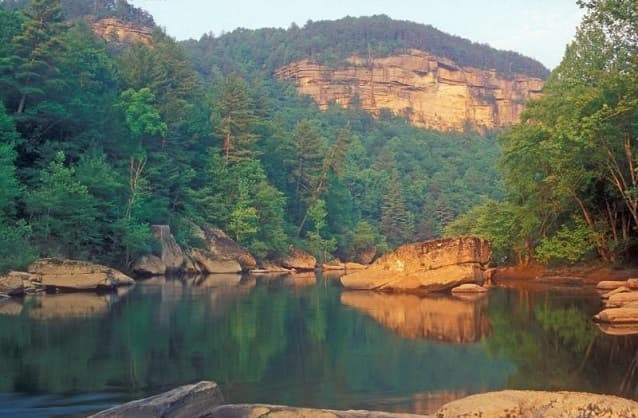
The Big South Fork of the Cumberland River is a significant river system in Tennessee and Kentucky, carved into the Cumberland Plateau. This 76-mile waterway is characterized by rugged terrain with deep gorges, natural arches, and rock shelters, and is the central feature of the Big South Fork National River and Recreation Area. Its formation by river erosion has created a diverse ecosystem and a popular destination for outdoor recreation.