
Provo Canyon
River Canyon·North America·Provo River
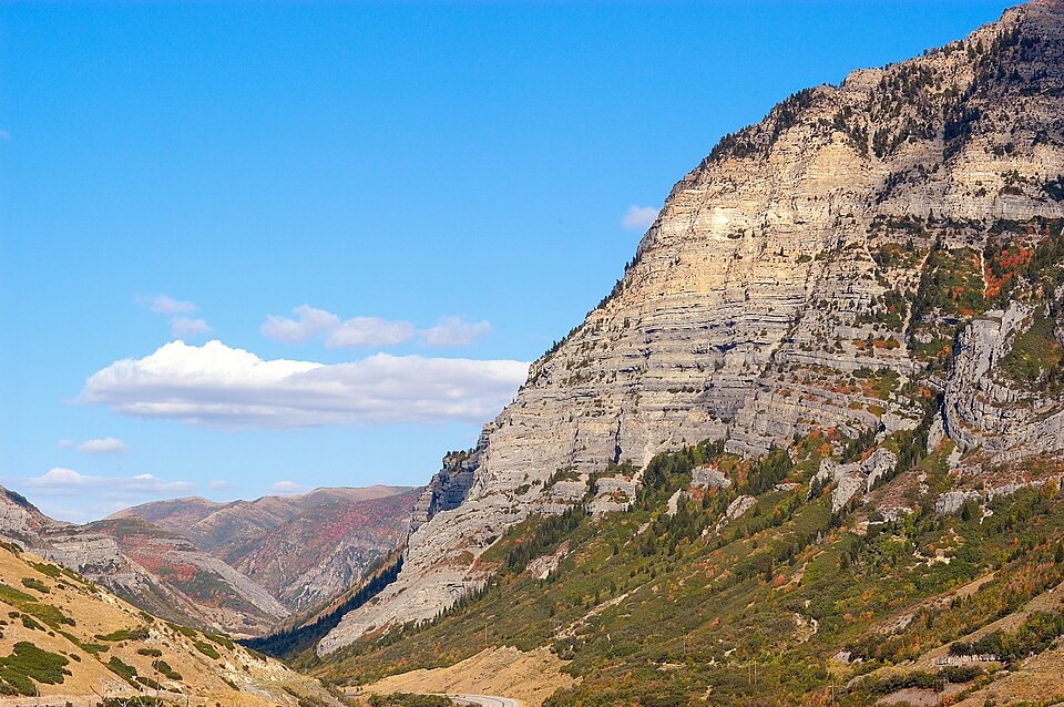
Provo Canyon is a prominent natural and transportation corridor in Utah, carved by the Provo River. It serves as a vital link between Utah Valley and the Uinta Basin, offering access to numerous recreational attractions and historical sites. The canyon's development has been significantly shaped by early settlement, civil engineering projects like hydroelectric power generation and reservoir construction, and its role as a transportation route.
Key Facts
- ›Carved by the Provo River through forces of erosion.
- ›Extends from Orem on the west to Heber City on the east.
- ›Features attractions such as Vivian Park, Sundance Resort, and Bridal Veil Falls.
- ›Deer Creek Reservoir within the canyon provides water storage for Salt Lake and Utah Valleys.
- ›Served as a crucial transportation route since early settlement, with U.S. Route 189 passing through it.
- ›Site of early hydroelectric power generation, including Nunn's Station, the world's first 40,000 Volt hydroelectric producer.
River Erosion
Bridal Veil Falls, Deer Creek Reservoir, Vivian Park, Sundance Resort, Nunn's Park
About Provo Canyon
Provo Canyon is a significant natural and transportation corridor located in unincorporated Utah County and Wasatch County, Utah. It stretches between the prominent peaks of Mount Timpanogos to the north and Mount Cascade to the south, extending from Orem on its western end to Heber City on the east. The canyon serves as a crucial access point to the valleys and the Uinta Basin, regions situated beyond the Wasatch Front.
Geological Formation and Natural Attractions
The canyon's dramatic landscape was primarily sculpted over time by the erosive power of the Provo River. This geological process has created a diverse environment that hosts numerous natural attractions. Among the most notable are Vivian Park, a popular recreational area; Sundance Resort, renowned for its skiing and summer activities; and the spectacular Bridal Veil Falls, a waterfall cascading approximately 617 feet. The canyon also encompasses Deer Creek Reservoir, a substantial body of water important for water storage and recreational pursuits in the region.
Historical Significance and Development
Provo Canyon's history is deeply intertwined with human settlement and development. In its early days, it served as an essential route for the Timpanogos Utes to travel between Utah Valley and the Uinta Basin. Mormon settlers, arriving in the mid-19th century, recognized its strategic value for expansion. The establishment of the Provo Road Company in 1855 and the completion of its road in 1858 marked a pivotal moment, facilitating westward expansion and the settlement of communities east of the Wasatch Mountains. The canyon later became a site for significant civil engineering achievements, including the construction of Nunn's Station in 1899, which was the world's first 40,000-volt hydroelectric producer, and the completion of the Deer Creek Reservoir in 1941, one of Utah's first large reservoirs designed primarily for culinary water.
Transportation and Modern Use
As a vital artery, Provo Canyon has always been a key transportation route. U.S. Route 189, also known as Provo Canyon Road, traverses the canyon, linking the western valleys with Heber City. The Heber Valley Historic Railroad, often nicknamed the "Heber Creeper," also operates a scenic passenger route through a section of the canyon, offering a glimpse into the area's past transportation methods. Today, Provo Canyon continues to be valued for its natural beauty, recreational opportunities, and its enduring role as a critical link within Utah's infrastructure.
Source: Wikipedia ↗
Frequently Asked Questions
How was Provo Canyon formed?
Provo Canyon was primarily carved by the Provo River through the natural process of erosion over a significant period. The river's persistent action has sculpted the landscape, creating the canyon's distinct topography.
What are the main attractions in Provo Canyon?
Key attractions include Vivian Park, a popular recreation area; Sundance Resort, known for skiing and summer activities; and the majestic Bridal Veil Falls, a 617-foot waterfall. Deer Creek Reservoir is also a significant feature for water storage and recreation.
What is the historical significance of Provo Canyon?
Historically, Provo Canyon was an essential connection for the Timpanogos Utes and a strategic route for Mormon settlers expanding into areas east of the Wasatch Mountains. It has been a vital transportation corridor since the construction of the Provo Road Company's road in 1858.
What transportation methods are available in Provo Canyon?
U.S. Route 189, also known as Provo Canyon Road, provides access through the canyon, connecting Orem and Provo with Heber City. The Heber Valley Historic Railroad also operates passenger trains on a scenic route through a portion of the canyon.
What kind of geological features can be found in Provo Canyon?
The canyon is characterized by its eroded rock formations carved by the Provo River. Notable features include Bridal Veil Falls and the Deer Creek Reservoir, which is a man-made reservoir created for water storage. The canyon walls are shaped by the erosive forces of the river and the surrounding mountainous terrain.
Are there any notable historical structures or projects in Provo Canyon?
Yes, Provo Canyon was the site of Nunn's Station, the world's first 40,000-volt hydroelectric producer, built in 1899. Additionally, the Deer Creek Reservoir, completed in 1941, was the first large man-made reservoir in Utah primarily for culinary water.
Related Canyons

Bad Rock Canyon
Bad Rock Canyon is a river canyon located east of Columbia Falls, Montana, through which the Flathead River flows. Historically, it served as a significant buffalo trail for various indigenous tribes and later became a gateway to wilderness areas like the Bob Marshall Wilderness and Glacier National Park. The canyon is also known for frequent rock slides that impact the adjacent BNSF Railway tracks.

Big Bend National Park
Big Bend National Park is a vast protected area in West Texas, notable for its extensive Chihuahuan Desert topography and ecology. Formed by the erosive power of the Rio Grande and significant geological uplift, the park preserves a rich tapestry of life, including over 1,200 plant species and hundreds of animal species, as well as ancient fossils and diverse rock formations. Its remote location and dramatic landscapes, including the Chisos Mountains and deep river canyons, make it a significant destination for naturalists and adventurers.
Big South Fork of the Cumberland River
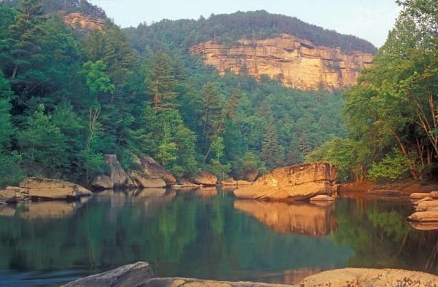
The Big South Fork of the Cumberland River is a significant river system in Tennessee and Kentucky, carved into the Cumberland Plateau. This 76-mile waterway is characterized by rugged terrain with deep gorges, natural arches, and rock shelters, and is the central feature of the Big South Fork National River and Recreation Area. Its formation by river erosion has created a diverse ecosystem and a popular destination for outdoor recreation.