
Richtis Gorge
Richtis Gorge is a state-protected park in eastern Crete, Greece, known for its diverse hiking experience. The gorge, formed by natural erosion, stretches approximately 4 km from the village of Exo Mouliana to Richtis beach, featuring rich vegetation, historical stone bridges, water mills, and culminating in the Richtis Waterfall.
Key Facts
- ›The hiking trail through the gorge is approximately 4 km long.
- ›The elevation difference between the starting point and Richtis beach is about 350 meters.
- ›The gorge is characterized by rich vegetation, including platanus trees, wild berries, local flowers, and herbs.
- ›Notable features include old stone bridges, water mills, and the Richtis Waterfall.
- ›The name "Richtis" in the Cretan dialect means "waterfall".
- ›The gorge is almost entirely shaded, offering a pleasant hiking experience.

Φαράγγι του Ρίχτη, Faraggi tou Richti
River Erosion
Richtis Waterfall, Old Stone Bridges, Water Mills
Butterflies, Small Reptiles, Birds, Small Mammals
Platanus Trees, Wild Berries, Local Flowers, Herbs
About Richtis Gorge
Richtis Gorge: A Natural Haven in Crete
Richtis Gorge, also known by its Greek name Φαράγγι του Ρίχτη (Faraggi tou Richti), is a state-protected park located in eastern Crete, Greece. This natural wonder begins in the traditional village of Exo Mouliana and meanders approximately 4 kilometers to the secluded Richtis beach. The gorge is renowned for its rich biodiversity and the diverse hiking experience it offers, making it a significant natural attraction in the region.
Geological and Ecological Significance
The gorge's formation is a testament to natural erosion processes, creating a dramatic landscape with an elevation difference of about 350 meters from its start to its end at the coast. Hikers traversing the trail are treated to an abundance of flora, including platanus trees, wild berries, and a variety of local flowers and herbs. The area also supports a range of fauna, with sightings of local species of butterflies, small reptiles, birds, and small mammals being common.
A significant feature of Richtis Gorge is its historical remnants, including old stone bridges and water mills, which hint at past human interaction with and utilization of the gorge's natural resources. The trail culminates in the striking Richtis Waterfall, a prominent landmark that gives the gorge its name, as "Richtis" in the Cretan dialect means "waterfall." The gorge is almost entirely shaded, which provides a comfortable environment for hiking, especially during the warmer months.
Hiking and Access
The hiking trail through Richtis Gorge is approximately 4 km long and offers varying levels of difficulty. While generally moderate in spring, summer, and autumn, it can become challenging in winter. Several options exist for exploring the gorge, from walking down and returning the same way to utilizing vehicles for access to the beach. The shaded nature of the gorge makes descending more advisable than ascending on a sunny day. The combination of natural beauty, historical elements, and the impressive waterfall makes Richtis Gorge one of the most diversified hiking experiences available in Crete.
Source: Wikipedia ↗
Frequently Asked Questions
What is the length of the Richtis Gorge hiking trail?
The hiking trail through Richtis Gorge is approximately 4 kilometers long. This length provides a diversified hiking experience with varying levels of difficulty depending on the season.
What is the elevation difference within Richtis Gorge?
The elevation difference between the starting point in Exo Mouliana and the secluded Richtis beach at the end of the gorge is about 350 meters. This creates a notable descent or ascent for hikers.
What kind of natural features can be found in Richtis Gorge?
The gorge boasts rich vegetation, including platanus trees, wild berries, local flowers, and herbs. Animal life such as butterflies, small reptiles, birds, and small mammals can also be observed.
Are there any historical structures in Richtis Gorge?
Yes, hikers can observe old stone bridges and water mills along the trail within Richtis Gorge. These structures offer a glimpse into the historical use of the area.
What is the meaning of the name "Richtis"?
In the Cretan dialect, "Richtis" translates to "waterfall." This name is fitting as the gorge culminates in the impressive Richtis Waterfall before reaching the beach.
What are the recommended hiking options for Richtis Gorge?
Several options exist, including walking down and returning the same way, walking down to the beach and returning via the road, or driving to the beach and walking part of the gorge. The gorge is almost entirely shaded, making it preferable to walk down rather than up on a sunny day.
Related Canyons
Samaria Gorge
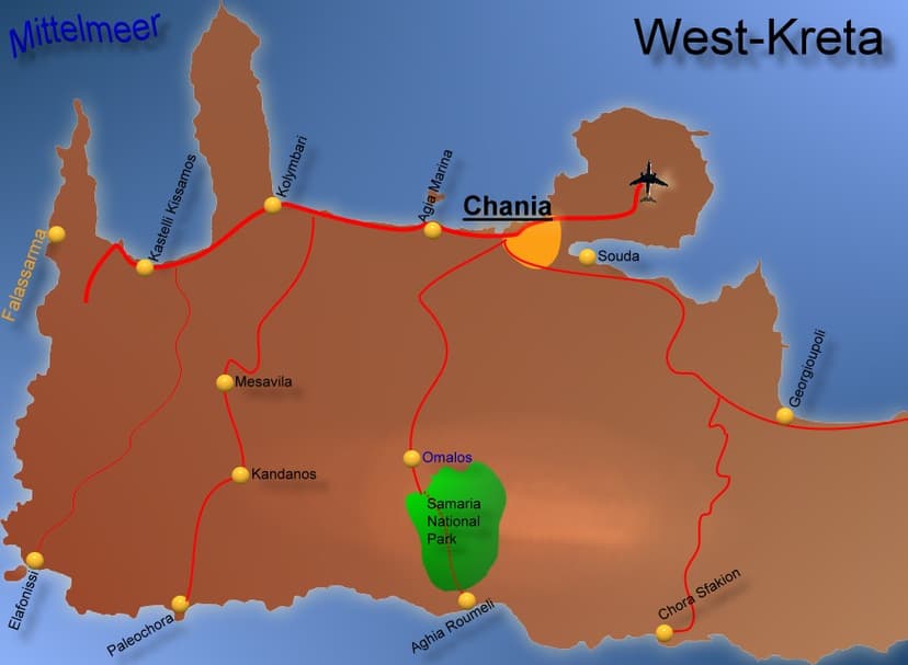
The Samariá Gorge is a National Park in southwest Crete, Greece, renowned as a major tourist attraction and a World's Biosphere Reserve. Carved by a small river between the White Mountains and Mt. Volakias, it stretches 16 km from an altitude of 1,250 m to the Libyan Sea. The gorge is significant as a refuge for the rare kri-kri (Cretan goat) and other endemic species.

Vikos Gorge
The Vikos Gorge is a dramatic gorge located in the Pindus Mountains of northwestern Greece, renowned for being the deepest canyon relative to its width in the world. Carved over millions of years by the Vikos Stream and the Voidomatis River, it showcases diverse geological strata and ecosystems. Historically, the area was utilized for pastoralism and is significant for its unique flora, with local healers known as "Vikos doctors" using medicinal herbs found within the gorge.

Agia Eirini Gorge
Agia Eirini Gorge is a scenic canyon located in southwestern Crete, Greece, renowned for its natural beauty and historical significance. Stretching 7.5 kilometers from the village of Agia Eirini to the coastal village of Sougia, it features steep mountain cliffs and forested areas. The gorge played a role in history, notably as an escape route for civilians during Ottoman rule.