
Salt River Canyon
River Canyon·North America·Salt River
Salt River Canyon is a significant wilderness area in Arizona, bisected by the Salt River. Its formation is primarily due to river erosion, creating a deep canyon with elevations ranging significantly from the riverbed to the surrounding rims. The canyon is a popular destination for white-water rafting and is traversed by U.S. Route 60 and Arizona State Route 77.
Key Facts
- ›Covers 32,115 acres (12,996 ha) within the Tonto National Forest.
- ›Elevations range from 2,200 feet (671 M) to 4,200 feet (1,280 M).
- ›The Salt River flows through the canyon, which is navigable by raft or kayak between March 1 and May 15.
- ›Features 27 sets of rapids and numerous side creeks for exploration.
- ›U.S. Route 60 and Arizona State Route 77 pass through the canyon.
- ›No maintained trails exist within the wilderness area.
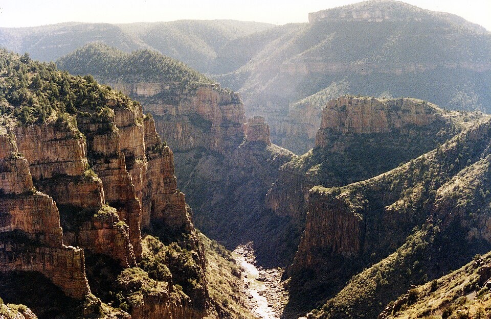
River Erosion
27 Sets of Rapids, Numerous Side Creeks
About Salt River Canyon
Salt River Canyon is a significant wilderness area situated within the Tonto National Forest in Arizona. This rugged landscape is dramatically bisected by the Salt River, which carves a deep canyon through its entirety. The area encompasses 32,115 acres (12,996 ha) and features a substantial range in elevation, from 2,200 feet (671 m) at its lower reaches to 4,200 feet (1,280 m) on White Ledge Mountain.
Recreational Opportunities
The canyon is a popular destination for white-water enthusiasts, particularly during the short river-running season which typically lasts from March 1 to May 15. During this period, travel through the canyon is best accomplished by raft or kayak. Visitors can experience 27 distinct sets of rapids and explore numerous side creeks. A permit is required for visitation during these dates, and group sizes are limited to 15 people.
Access and Geography
While the wilderness area itself lacks maintained trails, it is accessible via major roadways. U.S. Route 60 and Arizona State Route 77 traverse a winding path directly through the canyon. These routes descend to near the river at the canyon's bottom, cross the Salt River, and then ascend the opposite side, offering scenic views of the dramatic landscape.
Source: Wikipedia ↗
Frequently Asked Questions
What are the best times to visit Salt River Canyon for rafting?
The primary season for white-water rafting in Salt River Canyon is between March 1 and May 15. During this period, the river is typically navigable for activities like rafting and kayaking.
Are there any maintained trails in Salt River Canyon Wilderness?
No, there are no maintained trails within the entire Salt River Canyon Wilderness. Travel within the wilderness is primarily accomplished by raft or kayak on the river.
What kind of rapids can be expected in Salt River Canyon?
Salt River Canyon is known for its white-water rafting opportunities and features 27 sets of rapids. It also offers numerous side creeks to explore during the river-running season.
What roads go through Salt River Canyon?
The canyon is traversed by U.S. Route 60 and Arizona State Route 77. These routes wind through the canyon, descending close to the river before crossing it and ascending the opposite side.
What are the elevation ranges within Salt River Canyon?
The elevations within Salt River Canyon Wilderness vary considerably. They range from approximately 2,200 feet (671 m) at the lower end of the canyon to 4,200 feet (1,280 m) on White Ledge Mountain.
Related Canyons

Bad Rock Canyon
Bad Rock Canyon is a river canyon located east of Columbia Falls, Montana, through which the Flathead River flows. Historically, it served as a significant buffalo trail for various indigenous tribes and later became a gateway to wilderness areas like the Bob Marshall Wilderness and Glacier National Park. The canyon is also known for frequent rock slides that impact the adjacent BNSF Railway tracks.

Big Bend National Park
Big Bend National Park is a vast protected area in West Texas, notable for its extensive Chihuahuan Desert topography and ecology. Formed by the erosive power of the Rio Grande and significant geological uplift, the park preserves a rich tapestry of life, including over 1,200 plant species and hundreds of animal species, as well as ancient fossils and diverse rock formations. Its remote location and dramatic landscapes, including the Chisos Mountains and deep river canyons, make it a significant destination for naturalists and adventurers.
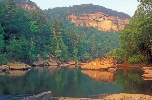
Big South Fork of the Cumberland River
The Big South Fork of the Cumberland River is a significant river system in Tennessee and Kentucky, carved into the Cumberland Plateau. This 76-mile waterway is characterized by rugged terrain with deep gorges, natural arches, and rock shelters, and is the central feature of the Big South Fork National River and Recreation Area. Its formation by river erosion has created a diverse ecosystem and a popular destination for outdoor recreation.