
Smoke Hole Canyon
Smoke Hole Canyon is a rugged 20-mile-long gorge carved by the South Branch Potomac River in eastern West Virginia's Allegheny Mountains. Its dramatic landscape is defined by steep cliffs and numerous caves, with its formation involving a significant "river piracy" event that diverted the river's course. Today, it is recognized as a biologically rich area and a site for primitive recreation.
Key Facts
- ›The canyon is approximately 32 km (20 miles) long.
- ›It is defined by North Fork Mountain to the west and Cave Mountain to the east.
- ›In places, the canyon reaches depths of over 300 meters (1,000 feet) with nearly vertical walls.
- ›Its formation involved a process of "river piracy" where the South Branch Potomac River's course was dramatically diverted.
- ›Caves are a common feature, with some serving as habitats for endangered Virginia big-eared bats.
- ›The area is part of the Monongahela National Forest's Spruce Knob–Seneca Rocks National Recreation Area.

The Smoke Holes, Smoke Hole
River Erosion, Stream Capture
Cave Mountain Anticline, Eagle Rock, High Rocks, Hermit Island, Smoke Hole Cave, Cave Mountain Cave, Rock Break
Virginia Big-Eared Bat
Rare Plant Communities, Sods, Cedar Barrens
About Smoke Hole Canyon
Smoke Hole Canyon: A Rugged Gorge of Natural and Historical Significance
Smoke Hole Canyon, traditionally known as "The Smoke Holes," is a dramatic 20-mile-long gorge situated in the Allegheny Mountains of eastern West Virginia. Carved by the South Branch Potomac River, this rugged canyon is renowned for its steep, nearly vertical walls, reaching over 1,000 feet in places, and its isolation, with parts accessible only by foot or boat. Defined by North Fork Mountain to the west and Cave Mountain to the east, Smoke Hole Canyon is a testament to powerful geological forces and a repository of rich human history.
Geological Formation and Features
The formation of Smoke Hole Canyon is a fascinating example of geological dynamism. The gorge was primarily shaped by a process known as "river piracy" or stream capture, where the South Branch Potomac River's course was dramatically diverted. This event involved extensive erosion, potentially through a subterranean channel that later collapsed, leading to the karst topography observed today. The canyon's geology is characterized by exposed anticlinal-synclinal structures, notably the Cave Mountain anticline, showcasing complex central Appalachian macroscale structures. Prominent geological features include Eagle Rock, High Rocks, and numerous caves, some of which are vital habitats for the endangered Virginia big-eared bat. The river itself features a narrow channel with fierce rapids known locally as the "Rock Break."
Historical Context and Human Settlement
The history of Smoke Hole Canyon is deeply intertwined with its isolated and rugged terrain. Early settlers began arriving in the mid-1750s, establishing homesteads and a traditional lifestyle supplemented by farming, hunting, and fishing. The origin of the "Smoke Hole" name is a subject of local lore, with theories ranging from Native American smokehouses to the misty fogs along the river, or most popularly, the fires from illicit liquor stills. The area gained notoriety for its production of "moonshine," a tradition that persisted through Prohibition and beyond. During the Civil War, caves in the canyon were utilized for saltpeter extraction. Despite its remoteness, the community maintained a keen interest in politics and local affairs.
Preservation and Modern Significance
In 1965, much of Smoke Hole Canyon was designated as part of the Monongahela National Forest's Spruce Knob–Seneca Rocks National Recreation Area, initiating efforts toward preservation. The Nature Conservancy has identified the area as "one of the most biologically rich places in the East," protecting its rare plant communities and wildlife habitats. Today, Smoke Hole Canyon offers opportunities for primitive recreation, including whitewater paddling on the South Branch Potomac River during spring months. While still retaining much of its wild character, the canyon serves as a valuable natural and historical resource, drawing visitors interested in its unique geology, ecology, and storied past.
Source: Wikipedia ↗
Frequently Asked Questions
How was Smoke Hole Canyon formed?
Smoke Hole Canyon was primarily formed through a geological process known as "river piracy" or stream capture. The South Branch Potomac River's original course was diverted westward into what is now the gorge, involving massive excavation and erosion, potentially through an underground channel that later collapsed.
What are the notable geological features of Smoke Hole Canyon?
The canyon is characterized by exposed anticlinal-synclinal structures, dominated by the Cave Mountain anticline. It features steep, nearly vertical walls, numerous caves, and prominent rock formations like Eagle Rock and High Rocks. The geology showcases complex central Appalachian macroscale structures.
What activities can visitors enjoy in Smoke Hole Canyon?
Visitors can enjoy whitewater paddling on the South Branch Potomac River, particularly during the spring when water levels are high enough for class II-III rapids. Hiking opportunities exist along trails like the North Fork Mountain Trail, offering views of the canyon and its unique flora.
Is Smoke Hole Canyon accessible to the public?
Parts of Smoke Hole Canyon are accessible by road, such as Smoke Hole Road (Grant County Route 28/11), which traverses the northern half of the canyon. However, some areas are remote and accessible only by boat or on foot. Certain caves are closed to visitors to protect bat populations.
What is the significance of the caves in Smoke Hole Canyon?
Caves are a significant geological feature in Smoke Hole Canyon. Some caves, such as those on Cave Mountain, have historically been sources of saltpeter. Other caves are crucial habitats for the endangered Virginia big-eared bat, leading to seasonal closures for visitor access.
Related Canyons

The Trough
The Trough is a six-mile-long wooded gorge carved by the South Branch Potomac River in the Allegheny Mountains of West Virginia. Defined by steep, forested slopes and ridges, it was the site of a notable skirmish during the French and Indian War. Today, it is a popular destination for canoeing and kayaking, known for its scenic beauty and as a habitat for bald eagles.
Partnach Gorge
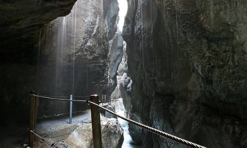
The Partnach Gorge is a deep gorge located near Garmisch-Partenkirchen in Bavaria, Germany. It was formed by the erosive power of the Partnach stream, which cut through layers of muschelkalk and softer marls over millions of years. Designated a natural monument in 1912, it has been developed for tourism and is accessible year-round.

Spearfish Canyon
Spearfish Canyon is a deep, narrow gorge in Lawrence County, South Dakota, carved by Spearfish Creek. Located in the Black Hills, it is traversed by the Spearfish Canyon Scenic Byway, which follows an old railroad grade. The canyon showcases ancient Precambrian rocks and a diverse ecosystem, making it a significant site for geological study and a popular natural attraction.