
The Trough
The Trough is a six-mile-long wooded gorge carved by the South Branch Potomac River in the Allegheny Mountains of West Virginia. Defined by steep, forested slopes and ridges, it was the site of a notable skirmish during the French and Indian War. Today, it is a popular destination for canoeing and kayaking, known for its scenic beauty and as a habitat for bald eagles.
Key Facts
- ›Approximately 9.7 km (6 miles) in length.
- ›Carved by the South Branch Potomac River.
- ›Bounded by MILL Creek Mountain and Sawmill Ridge.
- ›Features steep, forested slopes with oak, hickory, and Virginia pine.
- ›Known habitat for bald eagles.
- ›Site of the 1756 "Battle of the Trough" skirmish.

River Erosion
Steep Wooded Slopes, Mill Creek Mountain, Sawmill Ridge, Large Boulders, Spring Gaps, Old Bridge Piers
Bald Eagles
Oaks, Hickories, Virginia Pine, Paw Paw
About The Trough
The Trough is a significant natural gorge located in the Allegheny Mountains of Hampshire and Hardy Counties, West Virginia. Spanning approximately 6 miles (9.7 km) in length, this wooded canyon was carved by the South Branch Potomac River. Its steep slopes are densely forested with a mix of oaks, hickories, Virginia pine, and paw paw trees, with visible rock outcrops along its sides. The rugged terrain, defined by Mill Creek Mountain to the west and Sawmill Ridge to the east, makes direct access from either side challenging.
Geography and Access
The gorge officially begins for canoeists near the South Branch Valley Railroad's trestle at Sycamore, where Stony Run converges with the river. As the South Branch Potomac River flows northwest through The Trough, it navigates several bends, with large boulders dislodged from the surrounding ridges dotting its shores. The Trough transitions into Hampshire County near High Knob on Mill Creek Mountain. Sawmill Ridge terminates at the mouth of The Trough, where Sawmill Run meets the river. Communities such as Sector and Glebe lie near the river's mouth. Access to The Trough is primarily gained through the South Branch Valley Railroad, by boat, or on foot, with primitive campsites available along the river.
Recreation and Ecology
The Trough is a popular destination for recreational activities, particularly canoeing and kayaking, offering a scenic Class I-II whitewater run. The beauty of the stretch is enhanced by its role as a habitat for bald eagles, a fact celebrated by the Potomac Eagle Scenic Railroad that operates in the vicinity. Visitors can experience the area via sightseeing trains departing from Wappocomo Station. The Trough General Store in Glebe provides essential services such as canoe rentals and shuttle arrangements for visitors wishing to explore the gorge.
Historical Context
Historically, The Trough holds significance as the location of a military engagement during the French and Indian War in 1756, known as the "Battle of the Trough." This event marks a point in the region's early colonial history. Evidence of past human endeavors, such as the concrete piers of a former road bridge, remain visible, hinting at the area's evolving human interaction over time.
Source: Wikipedia ↗
Frequently Asked Questions
What is the geological formation of The Trough?
The Trough is a gorge carved by the erosive force of the South Branch Potomac River. It is situated between the steep, wooded ridges of Mill Creek Mountain to the west and Sawmill Ridge to the east, with the river flowing through the valley they define.
What are the main recreational activities at The Trough?
The Trough is a popular destination for canoeing and kayaking, offering a scenic river run rated as Class I-II difficulty. Visitors can also access primitive campsites along the river.
How can one access The Trough?
Access to The Trough is limited due to its steep slopes. Entry is possible via the South Branch Valley Railroad, by boat on the river, or on foot. The Trough General Store offers canoe rentals and shuttle services.
Is The Trough known for any specific wildlife?
Yes, The Trough is well-known as a habitat for bald eagles. This avian presence is highlighted by the Potomac Eagle Scenic Railroad sightseeing train that operates in the area.
What is the historical significance of The Trough?
Historically, The Trough was the location of a skirmish during the French and Indian War in 1756, known as the "Battle of the Trough". The area also features visible remnants of past infrastructure, such as old bridge piers.
Related Canyons

Smoke Hole Canyon
Smoke Hole Canyon is a rugged 20-mile-long gorge carved by the South Branch Potomac River in eastern West Virginia's Allegheny Mountains. Its dramatic landscape is defined by steep cliffs and numerous caves, with its formation involving a significant "river piracy" event that diverted the river's course. Today, it is recognized as a biologically rich area and a site for primitive recreation.
Hells Canyon
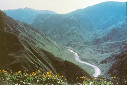
Hells Canyon is North America's deepest river gorge, carved by the Snake River along the borders of Oregon, Idaho, and Washington. Its dramatic landscape features immense depth and a diverse geological history spanning millions of years, from ancient volcanoes to basalt lava flows. The canyon is a significant natural area, offering abundant recreational opportunities and holding historical importance for indigenous tribes and early explorers.

Blackwater Canyon
Blackwater Canyon is a rugged, eight-mile gorge in eastern West Virginia, carved by the Blackwater River. Its dramatic landscape features steep cliffs, whitewater rapids, and dense forests, making it a site of both natural beauty and environmental controversy. For years, activists have advocated for its protection against industrial development interests.