
Windy Canyon
Canyon·New Zealand·andesite
Windy Canyon is a notable wind funnel located on Great Barrier Island, New Zealand, carved from andesitic rock. Situated on a high stretch of the island, it offers panoramic views of the surrounding lowlands and is traversed by the popular Palmers Track. The canyon is a significant natural feature, accessible via a well-maintained walking track.
Key Facts
- ›Located on Great Barrier Island, New Zealand.
- ›Formed from andesitic rock, shaped by wind erosion.
- ›Situated on a high elevation, close to Mount Hobson (621m).
- ›Offers views of Okiwi and Awana lowlands.
- ›Traversed by Palmers Track, a medium-difficulty walking trail.
- ›Accessible via a boardwalk and wooden stairs.

Wind Erosion
Wind Funnel Shape, Andesitic Rock Formations
About Windy Canyon
Windy Canyon Overview
Windy Canyon is a distinctive natural formation located on Great Barrier Island, New Zealand. It is characterized as a canyon and serves as a significant wind funnel, sculpted from andesitic rock. Its position on one of the island's higher elevations, less than 200 meters below the 621-meter summit of Mount Hobson, provides a dramatic geological setting.
Geological Significance and Formation
The canyon's unique shape is a result of wind erosion acting upon the andesitic rock. This process has created a natural funnel, a feature that defines its character and name. The geological composition of andesite is a key factor in how the wind has shaped this landscape over time.
Access and Activities
Windy Canyon is accessible via Palmers Track, a well-established walking route on the island. The initial part of the track, ascending from the Okiwi-Claris road, is enhanced with a boardwalk and wooden stairs to facilitate visitor access. This section takes approximately 15 minutes to reach the ridge.
Palmers Track continues further west towards Mount Hobson, offering a medium-difficulty hike. The round trip for this segment of the track typically takes between 3 to 4 hours. The trail is popular for those seeking to experience the natural beauty of Great Barrier Island and its unique geological formations.
Scenic Views
From Windy Canyon, visitors are treated to expansive views of the surrounding lowlands. To the north, the Okiwi lowlands are visible, while the Awana lowlands lie to the south. These vistas contribute to the canyon's appeal as a scenic destination on the island.
Source: Wikipedia ↗
Frequently Asked Questions
Where is Windy Canyon located?
Windy Canyon is situated on Great Barrier Island in New Zealand, specifically in the center-east part of the island. It is located on one of the island's higher stretches, not far from the summit of Mount Hobson.
How was Windy Canyon formed?
The canyon is a natural wind funnel that has been shaped from andesitic rock. Wind erosion is the primary geological process responsible for its distinctive form.
What is the best way to access Windy Canyon?
Palmers Track provides access through Windy Canyon. The initial section of the track, rising from the Okiwi-Claris road, features a boardwalk and wooden stairs, making it accessible.
What kind of activities can be done at Windy Canyon?
The primary activity at Windy Canyon is walking along Palmers Track. This track offers a scenic hike, taking approximately 3–4 hours for a return journey, and provides opportunities for enjoying the natural landscape and views.
What can be seen from Windy Canyon?
From Windy Canyon, visitors can enjoy views of the Okiwi lowland to the north and the Awana lowland to the south. The canyon's elevation also provides a vantage point for appreciating the island's topography.
Related Canyons

Buller Gorge
The Buller Gorge is a deep canyon carved by the Buller River in the northwest of New Zealand's South Island. It is named after Charles Buller, a prominent figure in the New Zealand Company. The gorge features New Zealand's longest swingbridge and is traversed by State Highway 6 and a railway line.

Cromwell Gorge
Cromwell Gorge is a steep gorge carved by the former Clutha River in New Zealand's Central Otago region. It winds between the Dunstan and Cairnmuir Mountains, historically significant for gold mining and fruit orchards. The gorge and parts of old Cromwell were flooded in the early 1990s to create Lake Dunstan behind the Clyde Dam.
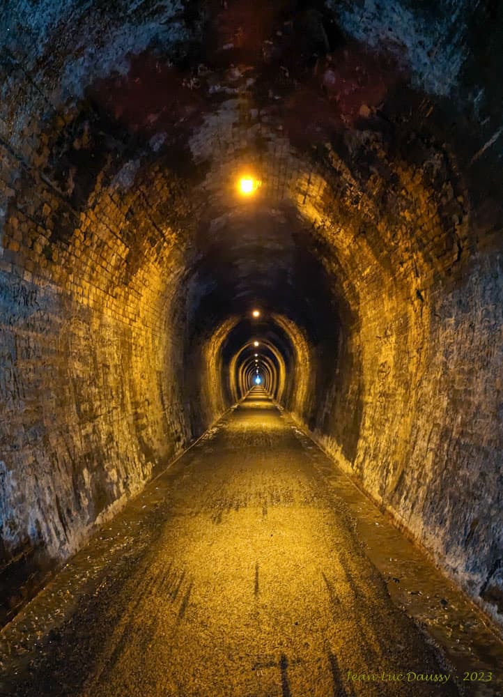
Karangahake Gorge
The Karangahake Gorge is a sharply winding canyon located between the Coromandel and Kaimai ranges in New Zealand's North Island. Carved by the Ohinemuri River, it was a significant site for gold mining from the 1880s to the 1950s, producing a substantial portion of New Zealand's gold output during its peak. Today, the gorge is a popular area for walking and cycling, with remnants of its mining past visible along its trails.