
Cayambe
Compound Volcano·Ecuador·South America·Alpine
Cayambe is a stratovolcano in Ecuador's Cordillera Central, notable for being the third-highest mountain in the country and the highest point on Earth crossed by the Equator. Its permanent snow cap and glaciers make it a significant geographical feature, particularly its south slope which is the highest point on the Equator with snow cover.
Key Facts
- ›Third-highest mountain in Ecuador at 5,790 meters (18,996 ft).
- ›Its south slope is the highest point on Earth crossed by the Equator and has snow cover.
- ›Last erupted in March 1786.
- ›Features a permanent snow cap covering approximately 22 km².
- ›Located within the Cayambe Coca Ecological Reserve.
- ›First climbed by Edward Whymper and his guides in 1880.

Known For
- Highest point on the Equator with snow cover
- Third-highest mountain in Ecuador
- Historical climbing destination
Permanent Snow Cap, Glaciers On Eastern and Western Flanks, Fissured Terrain, Bergschrund At Approximately 5,500 M, Cracks and Seracs On Final Ascent Stages
Cayambe Coca Ecological Reserve
About Cayambe
Cayambe, also known as Volcán Cayambe, is a prominent stratovolcano located in the Cordillera Central range of the Ecuadorian Andes. It stands as the third-highest mountain in Ecuador, reaching an elevation of 5,790 meters (18,996 ft) above sea level. The volcano is distinguished by its permanent snow cap and the fact that its south slope represents the highest point on Earth crossed by the Equator, uniquely possessing snow cover at this latitude.
Geological Significance and Eruptive History
Cayambe is a Holocene compound volcano, with its last recorded eruption occurring in March 1786. The permanent snow cap covers an area of approximately 22 square kilometers. The glaciers on its slopes descend to varying altitudes: around 4,400 meters on the eastern flank and about 4,700 meters on the drier western flank. The volcano and much of its mountainous terrain are protected within the Cayambe Coca Ecological Reserve.
Mountaineering and Exploration
The summit of Cayambe was first reached in 1880 by British adventurer Edward Whymper, accompanied by his Italian guides Jean-Antoine and Louis Carrel, who were instrumental in charting many of Ecuador's highest peaks. Today, Cayambe remains a popular destination for mountaineers. The primary climbing route involves navigating a terrain marked by moderate inclines, deep crevasses, and formidable ice formations, including a significant bergschrund at approximately 5,500 meters. The summit offers extensive panoramic views.
Cultural and Scientific Interest
Cayambe has captured the imagination of observers for centuries. Alexander von Humboldt noted its striking beauty, and his writings later inspired artist Frederic Edwin Church to depict the peak in his renowned painting, "The Heart of the Andes." Scientifically, Cayambe's peak holds the distinction of being the point on Earth's surface farthest from its axis, meaning it rotates the fastest as the planet spins.
Source: Wikipedia ↗
Frequently Asked Questions
Where is Cayambe located?
Cayambe is a volcano situated in the Cordillera Central range of the Ecuadorian Andes, specifically in Pichincha Province. It lies approximately 70 km northeast of Quito.
What is significant about Cayambe's location on the Equator?
Cayambe's south slope, at an elevation of 4,690 meters, is the highest point in the world that is crossed by the Equator. It is also the only point on the Equator that experiences snow cover.
When did Cayambe last erupt?
The volcano Cayambe last erupted in March 1786. It is classified as a Holocene compound volcano.
What are the dimensions of Cayambe's ice cap?
The permanent snow cap on Cayambe covers an area of about 22 square kilometers. Glaciers descend to approximately 4,400 meters on its eastern flank and reach about 4,700 meters on the drier western flank.
Who first climbed Cayambe?
Cayambe was first successfully climbed in 1880 by the British adventurer Edward Whymper, accompanied by his Italian guides Jean-Antoine Carrel and Louis Carrel. They were responsible for many first ascents of Ecuadorian volcanoes.
Related Glaciers

Antisana
Antisana is a stratovolcano located in the northern Andes of Ecuador, standing as the fourth highest volcano in the country. It is situated approximately 50 kilometers southeast of Quito and presents a formidable challenge for technical climbers.
Cotopaxi
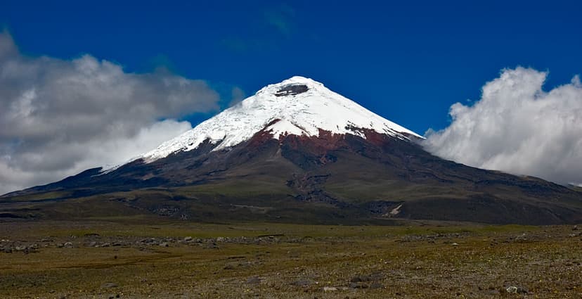
Cotopaxi is an active stratovolcano in Ecuador's Andes Mountains, renowned for its near-perfect conical shape and its significant equatorial glacier. It is one of the world's highest active volcanoes and has a history of frequent and powerful eruptions, which have shaped the surrounding landscape with lahars and pose a risk to nearby populations.

El Altar
El Altar, also known as Capac Urcu, is an extinct stratovolcano located in Sangay National Park, Ecuador. Its striking horseshoe-shaped ridge of nine peaks, surrounding a central crater lake, makes it a geologically significant and visually dramatic mountain. It is renowned as one of Ecuador's most technically challenging climbs, while also offering accessible hiking routes to its crater lake.