
Vanch-Yakh Glacier
Valley Glacier·Tajikistan·Asia·Alpine
The Vanch-Yakh Glacier, also known as the Fedchenko Glacier, is a significant ice formation in the Pamir Mountains of Tajikistan. It holds the distinction of being the longest glacier outside of the Earth's polar regions, making it a crucial feature for understanding glacial dynamics in mid-latitude mountain ranges.
Key Facts
- ›It is the longest glacier in the world outside of the polar regions.
- ›The glacier extends for approximately 77 kilometers (48 miles).
- ›Its surface area covers over 700 square kilometers (270 sq MI).
- ›The maximum thickness of the ice is estimated at 1,000 meters (3,300 ft).
- ›It begins at an elevation of 6,200 meters (20,300 ft) and ends at 2,909 meters (9,544 ft).
- ›Its waters eventually drain into the Aral Sea via several major rivers.

Known For
- Longest glacier outside polar regions
About Vanch-Yakh Glacier
The Vanch-Yakh Glacier, also known by its historical Russian name Fedchenko Glacier, is a monumental ice formation situated in the Yazgulem Range of the Pamir Mountains in north-central Gorno-Badakhshan province, Tajikistan. It holds the distinction of being the longest glacier found anywhere in the world outside of the Earth's polar regions. This massive glacier is characterized by its long and narrow profile, currently extending for approximately 77 kilometers (48 miles) and covering a vast area exceeding 700 square kilometers (270 sq mi).
Path and Hydrology
The Vanch-Yakh Glacier generally flows in a northward direction, passing to the east of the prominent Garmo Peak. Its icy expanse originates at an impressive elevation of 6,200 meters (20,300 ft). The glacier gradually melts and discharges its waters into the Balandkiik River, near the border with Kyrgyzstan, at an elevation of 2,909 meters (9,544 ft). The meltwater from Vanch-Yakh Glacier is a crucial component of the regional water system, eventually feeding into the Muksu, Surkhob, Vakhsh, and Amu Darya rivers, and ultimately making its way to the Aral Sea.
Exploration and Change
The glacier was first discovered in 1878. However, its full extent and characteristics were not comprehensively understood until a German-Soviet expedition, led by Willi Rickmer Rickmers, explored it in 1928. Historical records indicate periods of significant glacial activity; between 1910 and 1913, the glacier advanced by 800 to 1,000 meters (870 to 1,090 yd), notably blocking the Balyandlik River. Following this period of expansion, the glacier began to recede between 1928 and 1960, with its inflows, such as the Kosinenko and Ulugbeck glaciers, diminishing.
In recognition of national heritage, Tajikistan officially renamed the glacier from Fedchenko to Vanch-Yakh in 2023 as part of a derussification initiative.
Source: Wikipedia ↗
Frequently Asked Questions
What is the Vanch-Yakh Glacier?
The Vanch-Yakh Glacier, formerly known as the Fedchenko Glacier, is a large and lengthy glacier located in the Yazgulem Range of the Pamir Mountains in Tajikistan. It is notable for being the longest glacier outside of the polar regions.
Where is the Vanch-Yakh Glacier located?
The glacier is situated in the north-central Gorno-Badakhshan province of Tajikistan, within the Yazgulem Range of the Pamir Mountains.
How long and wide is the Vanch-Yakh Glacier?
The glacier is long and narrow, currently extending for approximately 77 kilometers (48 miles) and covering an area of over 700 square kilometers (270 sq mi).
What is the elevation range of the Vanch-Yakh Glacier?
The Vanch-Yakh Glacier originates at an elevation of 6,200 meters (20,300 ft) and terminates at 2,909 meters (9,544 ft) where it melts and empties into the Balandkiik River.
What is the estimated volume of the Vanch-Yakh Glacier?
The volume of the Vanch-Yakh Glacier and its numerous tributaries is estimated to be around 144 cubic kilometers (35 cu mi), which is roughly a third of the volume of Lake Erie.
When was the Vanch-Yakh Glacier discovered?
The glacier was discovered in 1878. However, it was not fully explored until 1928 by a German-Soviet expedition.
Has the Vanch-Yakh Glacier's size changed over time?
Between 1910 and 1913, the glacier expanded significantly, moving forward by 800 to 1,000 meters and temporarily blocking the Balyandlik River. It subsequently receded between 1928 and 1960.
What river systems does the Vanch-Yakh Glacier feed into?
The meltwater from the Vanch-Yakh Glacier flows into the Balandkiik River. This water then feeds into the Muksu, Surkhob, Vakhsh, and Amu Darya rivers, ultimately reaching the Aral Sea.
Related Glaciers

Batura Glacier
Batura Glacier is one of the largest and longest glaciers found outside of the polar regions, stretching 57 km in length. Located in the upper Hunza region of Gilgit-Baltistan, Pakistan, it flows west to east and is notable for its debris-covered lower portions and proximity to the Karakoram Highway, making it a subject of scientific study.
Siachen Glacier
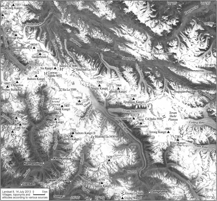
The Siachen Glacier is a major glacier in the eastern Karakoram range of the Himalayas, notable for its significant length and strategic importance. It is the longest glacier in the Karakoram and the second longest in the world's non-polar regions, feeding vital river systems like the Indus. The glacier has become a site of prolonged military dispute between India and Pakistan.

Baltoro Glacier
The Baltoro Glacier is a major glacier located in the Karakoram range of Pakistan-administered Kashmir. It is renowned for being surrounded by some of the world's highest peaks, including K2, and serves as a critical source for the Braldo River, which eventually flows into the Indus. Scientific observations suggest the glacier is not retreating but undergoes surges, making it a dynamic and significant feature of the region.