
Araguainha
Brazil·Permian-Triassic·Paleozoic·Complex crater
The Araguainha crater, located on the border of Mato Grosso and Goiás states in Brazil, is the largest known impact crater in South America, measuring 40 kilometers in diameter. Its age, estimated at 254.7 million years ago, closely overlaps with the Permian-Triassic extinction event, suggesting a potential, though indirect, role in this catastrophic global event.
Key Facts
- ›Diameter: 40 kilometers (25 MI)
- ›Age: 254.7 ± 2.5 million years ago
- ›Geological Period: Permian-Triassic boundary
- ›Location: Mato Grosso and Goiás states, Brazil
- ›Morphology: Complex crater with uplifted central core and annular faults
- ›Significance: Largest known impact crater in South America

Shattered Rock, Shocked Quartz, Impact Breccias, Shatter Cones
About Araguainha
Araguainha Crater
The Araguainha crater, also known as the Araguainha dome, is a significant impact structure located on the border of Mato Grosso and Goiás states in Brazil. It holds the distinction of being the largest known impact crater in South America, with a substantial diameter of 40 kilometers.
Geological Context and Dating
This massive crater was formed approximately 254.7 ± 2.5 million years ago. This precise dating is particularly noteworthy as it closely aligns with the Permian-Triassic extinction event, the most severe mass extinction in Earth's history, which wiped out a vast majority of species. The impact penetrated Paleozoic sedimentary rocks of the Paraná Basin, exposing the underlying Ordovician granite basement. The initial impact is estimated to have created a crater 24 kilometers wide and 2.4 kilometers deep, which subsequently widened to its present size as the walls subsided.
Morphology and Features
Araguainha is classified as a complex crater, characterized by its exposed surface and the erosive action of the Araguaia River, which cuts through it. The crater exhibits a central uplifted core, shaped like an elliptical basin and composed of exposed granite. Surrounding this core are concentric rings: an inner ring of shocked granite and breccias, followed by a ring of ridges and mountains up to 150 meters high, formed from folded and tilted Devonian sandstones. An annular depression, floored by Devonian and Carboniferous sandstones, encircles this central region. The outer rim consists of remnants of semi-circular grabens within highly deformed Permo-Carboniferous sediments. Definitive evidence of its impact origin includes the presence of shatter cones, impact breccias, and shocked quartz.
Interpretation and Potential Effects
While the energy released by the Araguainha impact is not believed to be the sole direct cause of the global Permian-Triassic extinction, its colossal local earth rifting could have released immense quantities of oil and gas from the fractured rock. This release may have contributed to rapid global warming, potentially precipitating the mass extinction. Evidence of seismites and tsunamites, linked to the impact, further underscore the event's destructive local and regional power, including the generation of an epicontinental megatsunami.
Discovery and Recognition
Initial reports in 1969 interpreted the Araguainha structure as a sedimentary uplift caused by a Cretaceous syenite intrusion. Subsequent geological surveys in the 1970s suggested a crypto-volcanic origin. However, the presence of impact breccias and shocked quartz, identified by Dietz and French in 1973, led to its recognition as an impact crater. Detailed studies in the 1980s and later provided further petrological, mineralogical, and geomorphologic evidence confirming its impact nature. Dating efforts have refined its age, with the most recent estimates placing it at 254.7 ± 2.5 million years ago.
Source: Wikipedia ↗
Frequently Asked Questions
Where is the Araguainha crater located?
The Araguainha crater is situated on the border of Mato Grosso and Goiás states in Brazil, between the villages of Araguainha and Ponte Branca. It is accessible by car from Goiânia or Cuiabá.
How large is the Araguainha crater?
The Araguainha crater has a diameter of 40 kilometers (25 miles), making it the largest known impact crater in South America. Initially, it was estimated to be 24 kilometers wide and 2.4 kilometers deep before its walls subsided.
When did the Araguainha impact event occur?
The Araguainha impact event is dated to 254.7 ± 2.5 million years ago. This timeframe closely overlaps with the Permian-Triassic extinction event, the most severe mass extinction in Earth's history.
What is the geological significance of the Araguainha crater?
The crater's age is significant because it aligns with the Permian-Triassic extinction event. While the impact's energy may not have been sufficient to directly cause the global extinction, the resulting rifting could have released vast amounts of oil and gas, potentially contributing to global warming and the extinction.
What is the geological structure of the Araguainha crater?
Araguainha is classified as a complex crater. It features an uplifted central core of granite, surrounded by rings of shocked granite, breccias, and folded sandstones. The outer rim consists of deformed Permo-Carboniferous sediments.
What evidence supports the Araguainha structure being an impact crater?
Evidence includes shatter cones, impact breccias, and shocked quartz. Early interpretations considered it a crypto-volcanic structure or an uplift caused by magma intrusion, but later studies confirmed its impact origin.
Related Impact Craters
Clearwater East
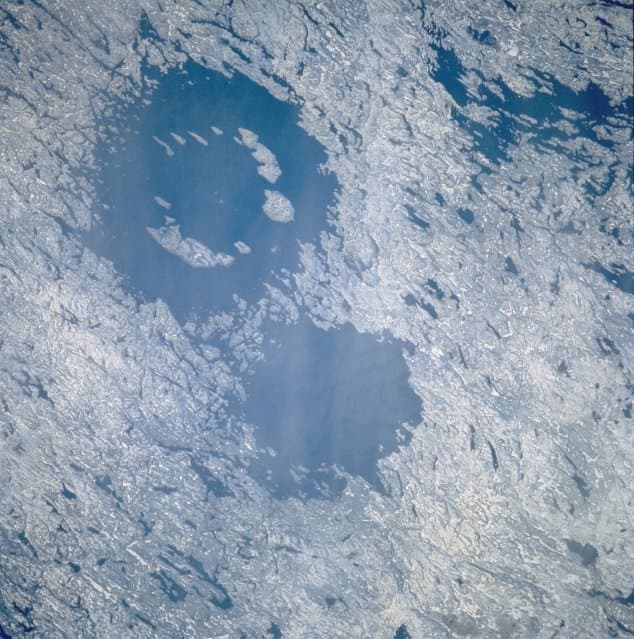
Clearwater East is one of two impact craters, forming the Clearwater Lakes in Quebec, Canada. This complex crater, with a diameter of 26 km, is estimated to be around 460-470 million years old, dating back to the Middle Ordovician period. Its central peak is submerged beneath lake water and sediments, but its presence has been confirmed through geological surveys and core drilling.
Kentland
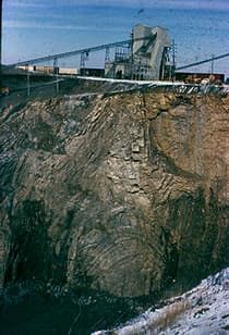
The Kentland structure, located in Newton County, Indiana, is a deeply eroded impact crater first identified by farmers in the late 19th century. Its geological significance lies in the extreme deformation of bedrock, including uplifted ancient rock layers and the presence of shatter cones, which confirmed its extraterrestrial impact origin by the late 1960s. The structure is currently an active quarry.

Serra da Cangalha
Serra da Cangalha is a significant impact crater located in Tocantins, Brazil, measuring between 12 and 13 kilometers in diameter. It is the second-largest known crater in Brazil and was formed approximately 220 million years ago during the Triassic period. The crater's name translates to "Pack-Saddle Mountains" in Portuguese, referencing its distinctive topography.