
Charlevoix
Canada·Ordovician to Silurian·stony asteroid·multi-ringed basin with a central uplift
The Charlevoix impact structure is a large, eroded meteorite impact site located in the Charlevoix region of Quebec, Canada. Estimated to have been 54 kilometers in diameter, its age is approximately 450 million years, making it a significant geological feature with a central uplift interpreted as a result of elastic rebound. The structure is classified as a multi-ringed basin, and its relatively smooth terrain has facilitated human settlement, with most of the region's population residing within its boundaries.
Key Facts
- ›Estimated original diameter of 54 kilometers.
- ›Age estimated at 450 ± 20 million years, dating to the Ordovician to Silurian period.
- ›Formed by a stony asteroid at least 2 kilometers in diameter.
- ›Features a central uplift, Mont des Éboulements, interpreted as a result of elastic rebound.
- ›Classified as a multi-ringed basin with a central uplift.
- ›Discovered in 1965 due to the presence of shatter cones.
Shatter Cones, Planar Deformation Features
About Charlevoix
Charlevoix Impact Structure
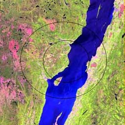
The Charlevoix impact structure is a significant, though substantially eroded, meteorite impact site located in the Charlevoix region of Quebec, Canada. It represents a substantial geological scar on the Earth's surface, with a considerable portion of the original structure lying concealed beneath the waters of the Saint Lawrence River.
Description and Formation
This impact structure is estimated to have originally spanned 54 kilometers (34 miles) in diameter. The cataclysmic event that formed it occurred approximately 450 ± 20 million years ago, placing its age within the Ordovician to Silurian periods. The celestial projectile responsible is believed to have been a stony asteroid, measuring at least 2 kilometers (1.2 miles) across. A key geological feature of the structure is the Mont des Éboulements, situated at its precise center. This prominent elevation is interpreted by scientists as a central uplift, a common characteristic of impact craters formed by elastic rebound following the initial impact.
The Charlevoix impact structure is classified geologically as a multi-ringed basin, distinguished by its central uplift. Evidence supporting its impact origin includes the widespread discovery of shatter cones in the surrounding area, which are distinctive conical rock fractures formed under extreme pressure. Additionally, planar deformation features (PDFs) have been identified in quartz and feldspar grains within the site, further substantiating its formation by a high-energy impact event.
Human Settlement and Visibility
In contrast to the rugged and craggy terrain of the adjacent Laurentian Mountains, the Charlevoix impact structure presents a relatively smooth and flat landscape. This topographical characteristic has historically facilitated human settlement in the region. Today, a remarkable 90% of the population of Charlevoix resides within the boundaries of this ancient impact structure, highlighting its influence on the human geography of the area.
Source: Wikipedia ↗
Frequently Asked Questions
What is the Charlevoix impact structure?
The Charlevoix impact structure is a large, eroded geological formation in Quebec, Canada, created by the impact of a meteorite. It is partly exposed at the surface and extends beneath the Saint Lawrence River.
How large is the Charlevoix impact structure?
The original impact structure is estimated to have been 54 kilometers (34 miles) in diameter. The celestial body that caused the impact was likely a stony asteroid at least 2 kilometers in diameter.
When did the impact event occur?
The impact event is estimated to have occurred approximately 450 ± 20 million years ago. This timeframe places it within the Ordovician to Silurian geological periods.
What type of crater is Charlevoix?
The Charlevoix impact structure is classified as a multi-ringed basin with a central uplift. The Mont des Éboulements, located at the center, is interpreted as this central uplift feature.
How was the Charlevoix impact structure discovered?
The impact origin of the Charlevoix structure was first recognized in 1965. This recognition followed the discovery of numerous shatter cones in the area, which are characteristic evidence of impact events.
What is the significance of the Charlevoix impact structure's terrain?
The impact structure is relatively smooth and flat compared to the surrounding Laurentian Mountains. This characteristic has made it conducive to human settlement, with a large portion of the Charlevoix population living within its boundaries.
Related Impact Craters
Clearwater East
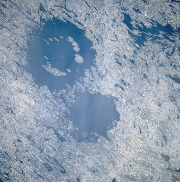
Clearwater East is one of two impact craters, forming the Clearwater Lakes in Quebec, Canada. This complex crater, with a diameter of 26 km, is estimated to be around 460-470 million years old, dating back to the Middle Ordovician period. Its central peak is submerged beneath lake water and sediments, but its presence has been confirmed through geological surveys and core drilling.
Slate Islands
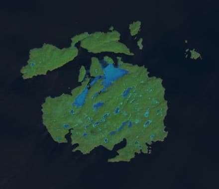
The Slate Islands are an archipelago in Lake Superior, Ontario, Canada, formed by a large meteorite impact. The impact created a crater estimated to be 32 km wide, with the remaining islands interpreted as a central uplift. Established as a provincial park in 1985, the islands are notable for their unique geology, including shatter cones, and for hosting Ontario's largest herd of boreal woodland caribou.

La Moinerie
La Moinerie is an 8 km wide impact crater located in Quebec, Canada, now filled with water to form Lac La Moinerie. Estimated to be 400 million years old, the crater's original features have been significantly eroded by glaciers.