
Chesapeake Bay
The Chesapeake Bay impact crater is a large, deeply buried structure located beneath the mouth of the Chesapeake Bay in the United States. Formed by a high-speed bolide impact approximately 35.5 million years ago, it is one of the best-preserved "wet-target" impact craters globally and has significantly influenced the region's geology, including the formation of the Chesapeake Bay itself.
Key Facts
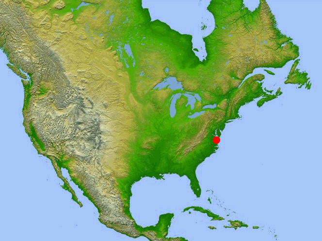
- ›The crater is located beneath the mouth of the Chesapeake Bay, United States.
- ›It was formed by a bolide impact approximately 35.5 ± 0.3 million years ago.
- ›The crater is about 85 km (53 MI) in diameter, though numerical modeling suggests an initial post-impact diameter of around 40 km (25 MI).
- ›The impact event caused a megatsunami and is the source of the North American tektite fields (Georgiaite and Bediasite).
- ›Evidence of the crater was first found in 1983 through drilling cores, with its full extent revealed by oil exploration data in 1993.
- ›The impact disrupted aquifers, creating a susceptibility to groundwater contamination in the lower Chesapeake Bay area.
Toms Canyon Structure
Tektites, Shocked Quartz Grains
About Chesapeake Bay
Chesapeake Bay Impact Crater
The Chesapeake Bay impact crater is a large, buried impact structure situated beneath the mouth of the Chesapeake Bay in the United States. This significant geological feature was created by the impact of a bolide approximately 35.5 million years ago, during the late Eocene epoch. It is recognized as one of the best-preserved "wet-target" impact craters globally, meaning it formed when the impact site was submerged under water.
Formation and Aftermath
The impact occurred when sea levels were high, and the eastern shore of North America was covered by thick tropical rainforest. The bolide struck with immense speed, penetrating the sedimentary layers and reaching the granite continental basement rock. This catastrophic event vaporized the bolide, fractured the bedrock to a depth of 8 km, and generated a central peak ring. The resulting crater, with an observed diameter of about 85 km, is surrounded by a terrace-like ring trough. Numerical models suggest the initial post-impact diameter may have been closer to 40 km.
The immediate aftermath was devastating, with a megatsunami engulfing the land and millions of tons of debris cast into the atmosphere. The crater's sedimentary walls slumped, widening the structure and forming a layer of collapsed blocks that were subsequently covered by breccia. The entire event, from impact to breccia deposition, transpired rapidly in geological terms. Over the subsequent millions of years, the crater was buried by accumulating sedimentary beds.
The Chesapeake Bay impact is also credited with forming the North American tektite fields, including the Georgiaite and Bediasite fields. Evidence of distal impact signatures, such as ejecta and tsunami deposits, has been found hundreds of kilometers away.
Discovery and Geological Significance
Initial evidence for a large impact crater beneath the Chesapeake Bay emerged in 1983 from a drilling core taken off the coast of New Jersey, which contained tektites and shocked quartz. The full extent of the crater was identified in 1993 through data gathered during oil exploration.
The impact has had lasting effects on the region's geology and hydrology. The ongoing slumping of material within the crater has influenced the flow of local rivers and played a role in shaping the Chesapeake Bay itself. Furthermore, the impact disrupted aquifers, leading to the current situation where freshwater aquifers lie above an ancient saltwater brine, making the lower Chesapeake Bay area vulnerable to groundwater contamination.
Source: Wikipedia ↗
Frequently Asked Questions
When did the Chesapeake Bay impact event occur?
The impact event that formed the Chesapeake Bay impact crater occurred approximately 35.5 ± 0.3 million years ago, during the late Eocene epoch.
How large is the Chesapeake Bay impact crater?
The entire circular crater is approximately 85 km (53 mi) in diameter and 1.3 km deep. However, numerical modeling suggests the initial post-impact diameter was likely around 40 km (25 mi).
What was the immediate aftermath of the impact?
The impact generated a megatsunami that engulfed the land and may have reached the Blue Ridge Mountains. Millions of tons of water, sediment, and shattered rock were ejected into the atmosphere.
How was the Chesapeake Bay impact crater discovered?
Evidence of a large impact crater was found in 1983 in a drilling core containing tektites and shocked quartz. The full extent of the crater was later revealed by oil exploration data in 1993.
What geological features are associated with the Chesapeake Bay impact?
The impact is identified as the source of the North American tektite fields, specifically the Georgiaite and Bediasite fields. Distal impact signatures, including ejecta and tsunami deposits, have also been found hundreds of kilometers away.
How has the Chesapeake Bay impact affected the local hydrology?
The impact created a long-lasting topographic depression that influenced the course of local streams and the eventual location of the Chesapeake Bay. It also disrupted aquifers, making the lower Chesapeake Bay area susceptible to groundwater contamination due to a deep salty brine layer.
Related Impact Craters
Logoisk
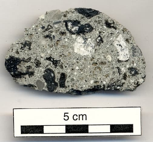
The Logoisk crater, also known as the Logoisk astrobleme, is a significant impact structure located in Belarus near the city of Lahoysk. This Eocene-era crater, estimated to be 42.3 million years old, has a diameter of 15 kilometers and is not visible on the surface, having been discovered through geological drilling.
Popigai
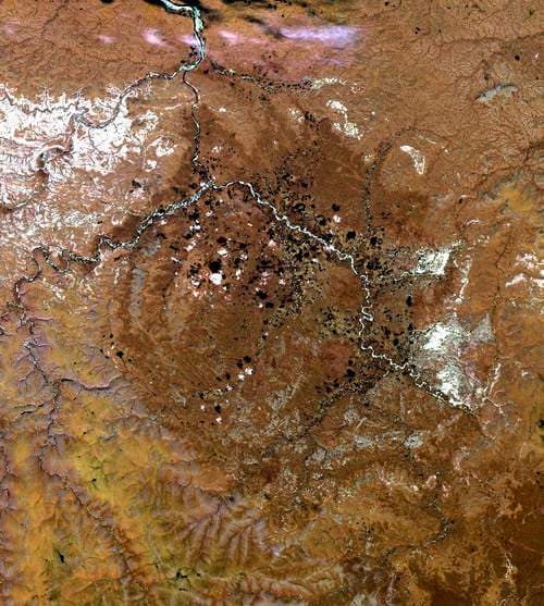
The Popigai impact structure is a significantly eroded remnant of a massive impact crater located in northern Siberia, Russia. It is recognized as one of the largest verified impact structures on Earth, created by a large bolide approximately 35 million years ago. The impact event is notable for transforming graphite into diamonds within a significant radius, making it a site of immense geological interest.
Kamensk
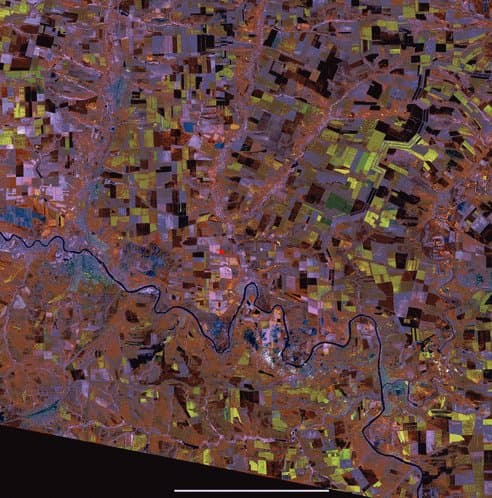
The Kamensk crater is a significant impact structure located in Rostov Oblast, Russia, approximately 10 to 15 kilometers north of Kamensk-Shakhtinsky town. With a diameter of 25 kilometers, its age is estimated to be around 49 million years old, dating back to the Eocene epoch. The crater is notable for being buried beneath the surface, making it invisible from ground level.