
Manicouagan
Manicouagan Reservoir, located in Quebec, Canada, is a prominent annular lake formed by an ancient meteorite impact. This impact structure, once a large crater, is now largely submerged beneath the reservoir and is famously known as the "eye of Quebec" due to its distinctive appearance from space.
Key Facts
- ›The Manicouagan impact structure is approximately 100 km (62 MI) in diameter.
- ›The impact occurred 214 (±1) million years ago, during the Late Triassic period.
- ›The celestial body that impacted Earth had a diameter of approximately 5 km (3 MI).
- ›The Manicouagan Reservoir, with its central René-Levasseur Island, is a prominent feature of the eroded crater.
- ›Shocked quartz from the Manicouagan impact has been found as far away as England and Japan.
- ›The current Manicouagan Reservoir was artificially created in the 1960s by damming rivers.

Rochechouart Impact Structure, Saint Martin Crater, Obolon' Crater, Red Wing Crater
Shocked Quartz
About Manicouagan
Manicouagan Impact Structure
Manicouagan Reservoir, sometimes referred to as Lake Manicouagan, is a significant annular lake located in the Côte-Nord region of Quebec, Canada. This distinctive geographical feature is the remnant of an ancient, deeply eroded impact crater, estimated to be the Earth's sixth-largest confirmed impact structure by rim-to-rim diameter.
Formation and Age
The Manicouagan crater was formed approximately 214 (±1) million years ago, during the Late Triassic period, by the impact of an asteroid with an estimated diameter of 5 kilometers. The initial impact excavated a crater that was originally about 100 kilometers wide. Over geological time, erosion and sedimentation have altered its appearance, but the structure remains evident.
Geography and Features
The most striking feature of the Manicouagan impact structure is the annular lake itself, which covers an area of 1,942 km2. At the center of the lake lies René-Levasseur Island, a prominent island plateau. Mount Babel, the highest peak on this island, is believed to be the central peak of the original impact crater, formed by post-impact uplift. The reservoir's current form is largely a result of a hydroelectric project initiated in the 1960s, which involved damming rivers and flooding the area, creating a massive headpond.
Scientific Significance
The Manicouagan impact event is notable for its widespread effects. Ejecta containing shocked quartz, a mineral formed under extreme pressure, has been found in rock layers as far away as England and Japan, indicating the global reach of the impact's consequences. While the impact's timing coincides with certain extinction events, such as the Adamanian-Revueltian turnover and a marine extinction in the middle Norian, direct causal links remain subjects of ongoing scientific investigation.
Visibility and Recognition
The Manicouagan Reservoir and its central island are so distinctive that they are clearly visible from space, earning it the nickname "the eye of Quebec." This visibility has contributed to its recognition as a significant geological site and a subject of interest for both scientific study and public fascination.
Source: Wikipedia ↗
Frequently Asked Questions
What is the Manicouagan Reservoir?
The Manicouagan Reservoir is an annular lake in central Quebec, Canada, covering an area of 1,942 km2. It is situated within the remnant of an ancient, deeply eroded impact crater and is often called the "eye of Quebec".
When did the Manicouagan impact occur?
The Manicouagan impact occurred approximately 214 (±1) million years ago, during the Late Triassic geological period. This timing predates the Triassic-Jurassic extinction event.
What caused the Manicouagan impact structure?
The structure was created by the impact of a meteorite, estimated to be about 5 km (3 mi) in diameter. This impact excavated a crater originally around 100 km wide.
What is René-Levasseur Island?
René-Levasseur Island is a large island located in the center of the Manicouagan Reservoir. It is essentially an inner plateau surrounded by the annular lake, with Mount Babel as its highest point.
Is the Manicouagan Reservoir a natural lake?
While the impact crater is natural, the present-day Manicouagan Reservoir was largely created in the 1960s by flooding existing lakes through the construction of the Daniel-Johnson dam as part of a hydroelectric project.
What is the geological significance of the Manicouagan impact?
The Manicouagan impact had widespread effects, with ejecta found globally. It has been suggested to be linked to a marine extinction event in the middle Norian and may have contributed to the decline of certain marine groups.
Related Impact Craters

Dellen
The Dellen lake system in Hälsingland, Sweden, is a prominent example of an impact crater. Formed approximately 89 million years ago during the Late Cretaceous period, the crater's impact created the unique geological formation known as Dellenite, which is now the provincial rock. The lake system itself is a popular destination for fly-fishermen, particularly for its brown trout population.
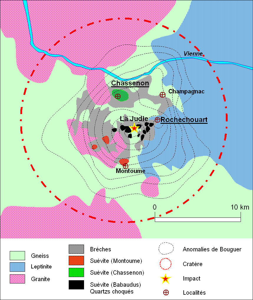
Rochechouart
The Rochechouart impact structure in France is a significant site for understanding asteroid impacts, despite its original crater being largely eroded away. Its recognition was crucial in debunking theories of cryptovolcanism and confirming impacts as a geological process. The structure is notable for preserving a complete sequence of impactite lithologies and shock metamorphic features.
Lappajärvi
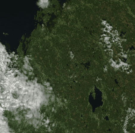
The Lappajärvi impact structure is a large, partly eroded meteorite crater in Finland, now occupied by a lake of the same name. It is one of the largest and youngest impact craters in Finland and is significant for scientific research, including projections for future landscapes. The area has also been recognized with a UNESCO Global Geopark application.