
Absaroka Range
Volcanic activity, tectonic uplift
The Absaroka Range is a significant sub-range of the Rocky Mountains, forming a substantial natural boundary in the northwestern United States. It plays a crucial role in defining the eastern edge of Yellowstone National Park and the Paradise Valley, while also marking the western perimeter of the Bighorn Basin. The range is notable for its volcanic geological history and its extensive protected wilderness areas.
Key Facts
- ›The Absaroka Range is a sub-range of the Rocky Mountains.
- ›It stretches approximately 150 miles (240 km) north-south across the Montana–Wyoming border.
- ›The highest peak is Francs Peak, reaching 13,153 feet (4,009 m) in Wyoming.
- ›Much of the range is situated within protected lands, including Yellowstone National Park and several wilderness areas.
- ›The geology includes volcanic breccia in Wyoming and transitions to granite and gneiss to the north.
- ›It is named after the Absaroka Native People, meaning 'children of the large-beaked bird'.

Volcanic Breccia, Granite, Gneiss
Yellowstone River, Bighorn River
Beartooth Pass
About Absaroka Range
The Absaroka Range
The Absaroka Range is a prominent sub-range of the Rocky Mountains, situated in the northwestern United States. This extensive mountain system stretches for approximately 150 miles (240 km) along the Montana–Wyoming border, with its widest point measuring about 75 miles (120 km) east to west. The range plays a critical role in the region's geography, serving as the eastern boundary of Yellowstone National Park and the Paradise Valley, while also defining the western edge of the Bighorn Basin. It is bordered by the Beartooth Mountains to the east and north, and the Wind River Range to the south and southwest.
Geography and Protected Lands
The Absaroka Range's rugged terrain is drained by the Yellowstone River and its tributaries, including the Bighorn River. A significant portion of the range is preserved within protected public lands. These include Yellowstone National Park itself, as well as several designated wilderness areas such as the Absaroka-Beartooth Wilderness, North Absaroka Wilderness, Teton Wilderness, and Washakie Wilderness. These protected zones span across national forests including the Bridger-Teton, Custer, Gallatin, and Shoshone National Forests, underscoring the ecological importance of the region.
Geological History
Geologically, the Absaroka Range exhibits a fascinating history, particularly related to volcanic activity. The section of the range located in Wyoming is characterized by volcanic breccia. As one moves northward across the state line, the bedrock transitions to granite and gneiss. The Absaroka Volcanic Province, covering a vast area of roughly 23,000 square kilometers in southwestern Montana and northwestern Wyoming, is a testament to this past volcanism. Extrusive igneous rocks from this province were erupted during the Eocene Epoch, between approximately 53 and 43.7 million years ago. The eroded remnants of large stratovolcanoes within this province offer geologists unique insights into volcanic structures.
Naming and Exploration
The range bears the name of the Absaroka Native People, a term derived from the Hidatsa name for the Crow people, meaning 'children of the large-beaked bird.' Early historical accounts suggest that John Colter may have been the first European American to traverse the area in 1807. Later explorers, such as Gustavus Cheyney Doane and Nathaniel P. Langford, ventured into the region, with Doane and Langford climbing Colter Peak in 1870.
Accessibility
Key transportation routes traverse or border the Absaroka Range. U.S. Highway 212, connecting Billings, Montana, to Yellowstone National Park, crosses over Beartooth Pass in the adjacent Beartooth Mountains before winding through the Absarokas. This route is typically only accessible during the summer months. Additionally, U.S. Route 14/16/20 follows the Shoshone River from Cody, Wyoming, through the range to the eastern entrance of Yellowstone National Park.
Source: Wikipedia ↗
Frequently Asked Questions
Where are the Absaroka Mountains located?
The Absaroka Range is located in the northwestern United States, stretching across the Montana–Wyoming border. It forms the eastern boundary of Yellowstone National Park and the Paradise Valley, and the western edge of the Bighorn Basin.
What is the highest peak in the Absaroka Range?
The highest peak in the Absaroka Range is Francs Peak, situated in Wyoming. It reaches an elevation of 13,153 feet (4,009 meters).
What is the geological origin of the Absaroka Range?
The Absaroka Range has a complex geological history, with the Wyoming section characterized by volcanic breccia. Further north, there is a transition to granite and gneiss bedrock. The Absaroka Volcanic Province contributed significant extrusive igneous rocks during the Eocene Epoch.
Which Native American people are the Absaroka Range named after?
The range is named after the Absaroka Native People. This name is derived from the Hidatsa term for the Crow people, meaning 'children of the large-beaked bird'.
Are there significant protected areas within the Absaroka Range?
Yes, a substantial portion of the Absaroka Range lies within protected lands. This includes Yellowstone National Park, the Absaroka-Beartooth Wilderness, North Absaroka Wilderness, Teton Wilderness, and Washakie Wilderness.
Related Mountain ranges

Adirondack Mountains
The Adirondack Mountains are a prominent massif in Northeastern New York State, forming a circular dome of ancient rocks uplifted by relatively recent geological processes. This region is significant for its extensive natural resources, recreational opportunities, and unique ecological transition zone, encompassing over 100 peaks and thousands of lakes and rivers within the vast Adirondack Park.
Aconcagua
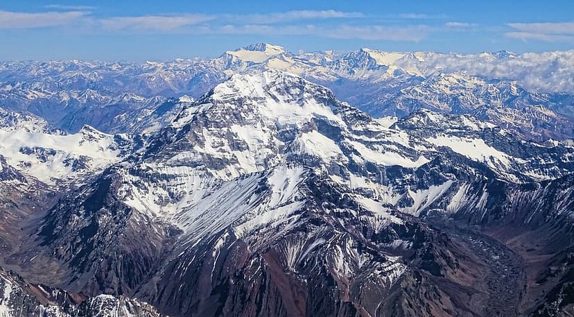
Aconcagua is the highest mountain in the Americas and the highest peak outside of Asia, located in the Andes mountain range in Mendoza Province, Argentina. It is a significant peak for mountaineers worldwide, often referred to as the highest non-technical mountain, though its extreme altitude presents considerable challenges and risks.

Accursed Mountains
The Accursed Mountains, also known as Prokletije, are a rugged mountain range in coastal Southeast Europe, forming the southernmost subrange of the Dinaric Alps. This range is notable for its dramatic glacial karst topography, rich biodiversity, and being one of the southernmost glacial masses in Europe. Its challenging terrain and unique geological formations have made it a subject of both scientific interest and local legend.