
Trout Pond
dissolution·Usa·Limestone (Tonoloway Limestone and Helderberg Group)
Trout Pond, formerly known as Old Pond, is West Virginia's only natural lake, formed by a sinkhole that filled with water from mountain streams. It is a karst feature located within the Trout Pond Recreation Area in the George Washington National Forest. While historically a stable body of water, recent underground structural changes in the underlying limestone have caused it to periodically drain, highlighting the dynamic nature of sinkhole formations.
Key Facts
- ›West Virginia's only natural lake.
- ›Formed by a sinkhole that filled with water from mountain streams.
- ›Located in the Trout Pond Recreation Area of the George Washington National Forest.
- ›Underlain by strata of Tonoloway Limestone and the Helderberg Group.
- ›Has experienced periods of draining due to underground structural changes in the limestone cavern.
- ›Formerly fluctuated between 2 and 3 acres in surface area.

Old Pond
West Virginia's Only Natural Lake, Karst Feature, Periodically Draining Sinkhole
Freshwater
Trout
About Trout Pond
What is Trout Pond?
Trout Pond, historically known as Old Pond, holds the distinction of being West Virginia's sole natural lake. It is a significant karst feature, originating from a sinkhole that has been replenished by a network of mountain streams flowing from Long Mountain. Located within the Trout Pond Recreation Area (TPRA) of the George Washington National Forest near Wardensville, Hardy County, it represents a unique hydrological phenomenon.
Geological Formation and Behavior
The formation of Trout Pond is directly linked to the geological makeup of the region, which is characterized by layers of limestone. Rainfall has slowly eroded these subterranean limestone layers, creating conical holes and caverns. While many sinkholes form and exist, Trout Pond's unique position allowed it to maintain a stable, lake-like status for an extended period. However, recent geological activity, specifically suspected shifts in the underlying limestone cavern, have drastically altered its behavior. Since July 2002, officials have observed significant drops in water levels, with the pond draining almost dry within a month due to these underground structural changes. While it can regenerate during prolonged wet periods, it tends to empty again as soon as dry spells occur.
Recreation and Management
The Trout Pond Recreation Area, established in the late 1970s, provides facilities for visitors, including a designated swimming area, lakeside trails, and fifty campsites, operating seasonally from early May through late October. Trout Pond has a history of being stocked with trout, which contributed to its current name. This practice was temporarily halted due to erosion of the banks caused by fishermen, highlighting the challenges in managing natural attractions that are also popular recreational sites.
Source: Wikipedia ↗
Frequently Asked Questions
What is Trout Pond?
Trout Pond is West Virginia's only natural lake, formed by a sinkhole that collected water from nearby mountain streams. It is situated within the Trout Pond Recreation Area in the George Washington National Forest.
Why does Trout Pond sometimes disappear?
Trout Pond has recently been experiencing periods of draining due to suspected shifts in the limestone cavern beneath it. These underground structural changes can cause the water level to drop significantly, sometimes leaving the pond almost dry.
What geological features are associated with Trout Pond?
Trout Pond is classified as a karst feature, meaning it is formed by the dissolution of soluble rocks like limestone. The area is underlain by strata of Tonoloway Limestone and the Helderberg Group.
What activities are available at Trout Pond?
The Trout Pond Recreation Area offers a designated swimming area, easy lakeside trails, and campsites. The area is also known for being stocked with trout, though fishing practices have led to bank erosion in the past.
When was Trout Pond created?
The article text indicates that Trout Pond was created by a sinkhole that filled with water from mountain streams. The geological processes that formed the sinkhole and the pond are ongoing, with recent changes impacting its water levels.
Related Sinkholes

Makauwahi Cave
Makauwahi Cave is the largest limestone cave in Hawaii, located on the south coast of Kauaʻi in the Māhāʻulepū Valley. It is geologically unique as a sinkhole paleolake within eolianite limestone, preserving nearly 10,000 years of sedimentary record. Its significance lies in its rich paleoecological and archaeological findings, offering insights into pre-human conditions and the ecological impact of human colonization.
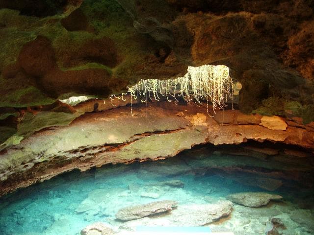
Devil's Den Cave
Devil's Den Cave is a unique solution sinkhole located near Williston, Florida, notable for its ancient paleontological discoveries and its transformation into a recreational SCUBA diving site. The cave features a karst window opening to a geothermally warmed underground river, which, during colder months, produces a visible steam plume reminiscent of a "chimney from Hell" to early settlers. Extensive fossil finds, including those of extinct Pleistocene animals alongside human remains and artifacts, have been documented within its underwater passages, offering a glimpse into prehistoric life.
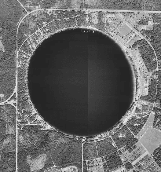
Kingsley Lake
Kingsley Lake is a nearly circular freshwater sinkhole lake located in Clay County, Florida, distinguished by its near-perfect round shape and its position atop Florida's ancient Trail Ridge. Formed by the dissolution of underlying limestone, it is an oligotrophic body of water with exceptional clarity and minimal nutrient levels, making it a valuable natural resource and a site of ecological and geological interest.