
Grand Canyon of the Stikine
River Canyon·Canada·Stikine River
The Grand Canyon of the Stikine is a significant 72-kilometer stretch of the Stikine River in northern British Columbia, Canada, renowned for its challenging whitewater and steep walls. Formed by the river cutting through sedimentary and volcanic rock, it has been compared to the Grand Canyon of the Colorado and is a legendary challenge for expert whitewater paddlers. The canyon is a protected area within the Stikine River Provincial Park, established to preserve its natural state.
Key Facts
- ›The canyon is a 72-kilometer (45 MI) section of the Stikine River.
- ›It is characterized by steep walls formed by river erosion through sedimentary and volcanic rock.
- ›The canyon reaches depths of up to 300 meters (984 ft) in places.
- ›Its width varies significantly, from 200 meters (656 ft) to as narrow as 2 meters (7 ft) at the Tanzilla Slot.
- ›It is considered one of the most challenging whitewater runs globally, often referred to as the "Mount Everest" of big water expeditions.
- ›The Stikine River Provincial Park was created in 2001 to protect this stretch of the river.

The big red
River Erosion
Tanzilla Slot, Wasson's Hole, V-Drive Rapid
Mountain Goats
About Grand Canyon of the Stikine
The Grand Canyon of the Stikine is a dramatic and challenging 72-kilometer (45 mi) gorge carved by the Stikine River in the northern interior of British Columbia, Canada. This formidable canyon has earned a legendary status among whitewater sports enthusiasts, often compared to the Grand Canyon of the Colorado for its scale and the intensity of its waters. It is home to a significant population of mountain goats and other diverse wildlife.
Formation and Characteristics
The canyon was formed by the relentless erosive power of the Stikine River cutting through layers of sedimentary and volcanic rock. In places, its steep walls plunge to depths of up to 300 meters (984 ft). The river's width within the canyon fluctuates dramatically, ranging from 200 meters (656 ft) to as narrow as 2 meters (7 ft) at a point known to kayakers as the "Tanzilla Slot." The canyon's distinctive coloration has led some to refer to it as "The big red."
A Legendary Whitewater Challenge
The Grand Canyon of the Stikine is officially deemed unnavigable by conventional watercraft. However, it represents a pinnacle of achievement for expert whitewater paddlers. Since the first descent attempt in 1981, it has been widely regarded as the "Mount Everest" of big water expedition boating, a benchmark against which other navigable rivers are measured. The canyon's whitewater is characterized by numerous grade V+ rapids, and expeditions typically take around three days to complete, though some elite kayakers have achieved single-day descents. Most attempts are made in early fall when water levels are lower, though the flow can vary significantly. The sheer vertical cliffs lining much of the canyon make exiting in an emergency an arduous and often perilous undertaking.
Conservation and Protection
In the late 20th century, proposals by BC Hydro for a five-dam hydroelectric project within the canyon generated significant opposition from conservationists and Indigenous groups, sparking a protracted campaign to protect the river. These efforts culminated in the establishment of the Stikine River Provincial Park in 2001. This park, encompassing 257,177 hectares, was created specifically to preserve the ecological integrity and natural beauty of this iconic stretch of the Stikine River.
Source: Wikipedia ↗
Frequently Asked Questions
How was the Grand Canyon of the Stikine formed?
The Grand Canyon of the Stikine was formed by the Stikine River cutting through layers of sedimentary and volcanic rock over time. This erosion carved out the steep-walled canyon that exists today.
Is the Grand Canyon of the Stikine navigable by boat?
Officially, the canyon is described as unnavigable by any watercraft. However, it is a renowned destination for expert whitewater paddlers who have successfully navigated its challenging rapids since the first attempt in 1981.
What makes the Grand Canyon of the Stikine so challenging for paddlers?
The canyon features numerous grade V+ rapids, extreme vertical cliffs that make exiting difficult, and highly variable water levels. Its reputation among whitewater experts is legendary, often considered the "Mount Everest" of big water expedition boating.
What are the dimensions of the Grand Canyon of the Stikine?
The canyon stretches for 72 kilometers (45 miles) along the Stikine River. Its depth can reach up to 300 meters (984 ft), and its width varies from 200 meters (656 ft) down to a narrow 2 meters (7 ft) at the Tanzilla Slot.
Is the Grand Canyon of the Stikine a protected area?
Yes, the Grand Canyon of the Stikine is protected within the Stikine River Provincial Park, which was established in 2001. The park covers 257,177 hectares and was created to safeguard this significant stretch of the river.
Related Canyons

Agawa Canyon
Agawa Canyon is a shallow canyon in Ontario, Canada, formed approximately 1.2 billion years ago by faulting and later carved by the Agawa River. It is now a popular tourist destination within the Agawa Canyon Wilderness Park, accessible by train or hiking trail, and is renowned for its natural beauty, waterfalls, and seasonal foliage.
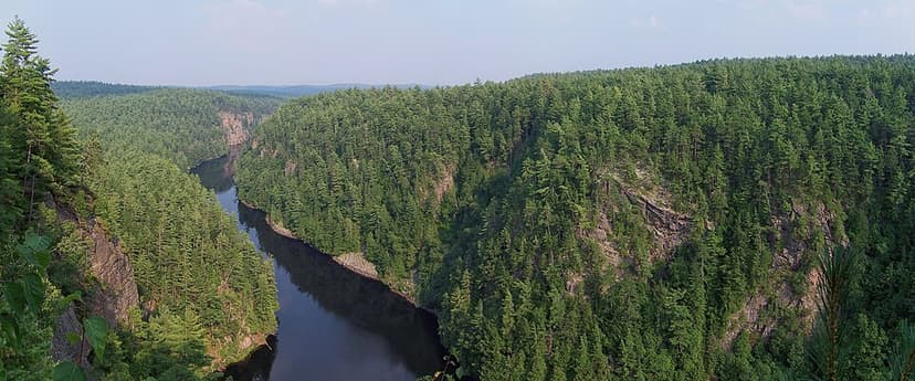
Barron River (Ontario)
The Barron River is a significant waterway in Ontario, Canada, flowing through Algonquin Provincial Park and forming the southern branch of the Petawawa River. It was primarily formed by glacial meltwater approximately 10,000 years ago, carving out the impressive Barron Canyon. Historically, it served as a crucial route for timber transport, with the canyon's towering cliffs known as the "Capes" by loggers.

Coaticook Gorge
The Coaticook Gorge is a prominent natural feature located in Coaticook, Quebec, within the Estrie region of Canada. Carved by the Coaticook River, this gorge is characterized by its significant depth and length, making it a notable geological site in the area. Its formation is attributed to the erosive power of the river over time.