
Waimea Canyon
River Canyon·United States·Waimea River·Basalt
Waimea Canyon, also known as the Grand Canyon of the Pacific, is a prominent canyon on the western side of Kauaʻi in the Hawaiian Islands. It was formed by the erosion of the Waimea River, fueled by extreme rainfall from Mount Waiʻaleʻale, and also by a massive volcanic collapse that shaped the island. The canyon is known for its steep, colorful walls, showcasing millions of years of geological history.
Key Facts
- ›Approximately 10 miles (16 km) long.
- ›Up to 3,000 feet (910 M) deep.
- ›Carved into tholeiitic and post-shield calc-alkaline lavas.
- ›Formation involved both river erosion and volcanic collapse.
- ›Walls have weathered from black basalt to bright red.
- ›Located within Waimea Canyon State Park.
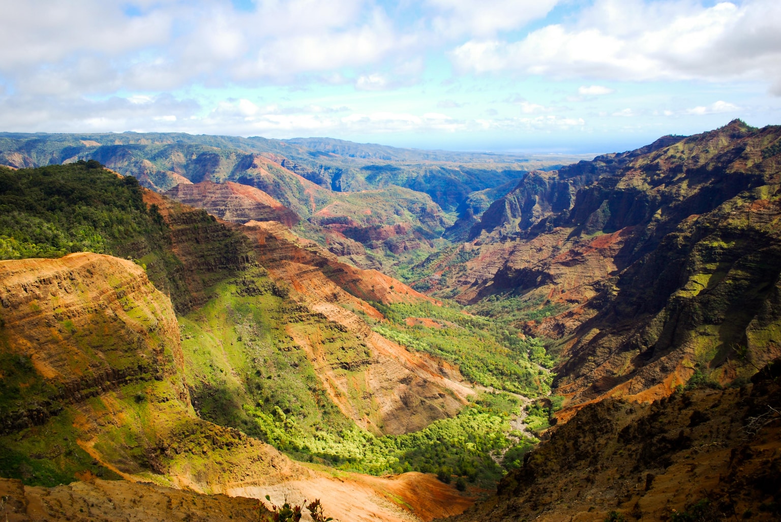
Grand Canyon of the Pacific
River Erosion, Volcanic Collapse
- Red Soil
- Steep Cliff Walls
- Fault Along Which Island Parts Moved Downwards
- Thick, Flat-Lying Lava Flows
- Thin, West-Dipping Lavas
Waimea
About Waimea Canyon
Waimea Canyon, often referred to as the "Grand Canyon of the Pacific," is a dramatic and expansive canyon located on the western side of Kauaʻi, one of the Hawaiian Islands in the United States. This natural wonder is approximately ten miles (16 km) in length and plunges to depths of up to 3,000 feet (910 m).
Geological Formation
The canyon's formation is a result of a dual geological process. Primarily, the Waimea River has deeply incised the landscape, a process intensified by the extreme rainfall that characterizes the island's central peak, Mount Waiʻaleʻale, one of the wettest places on Earth. Complementing this erosional force is a significant geological event: the catastrophic collapse of the volcano that originally formed Kauaʻi. This collapse created a massive depression, which subsequently filled with lava flows. Over millions of years, rainwater has sculpted the canyon along the edge of this ancient collapse. The exposed basaltic rock, originally black, has weathered into vivid shades of red, contributing to the canyon's striking visual appeal.
Geography and Access
Waimea Canyon is situated within Waimea Canyon State Park, an area of 1,866 acres that serves as a popular tourist attraction and a wilderness area featuring numerous hiking trails. Access to the canyon is available from the town of Waimea via Hawaiʻi state road 550. This 18-mile road ascends towards Kōkeʻe State Park, providing breathtaking vistas of the canyon and its surroundings. From certain viewpoints along this route, the island of Niʻihau, situated a short distance to the west of Kauaʻi, is clearly visible.
Source: Wikipedia ↗
Frequently Asked Questions
How was Waimea Canyon formed?
Waimea Canyon was formed by the deep incision of the Waimea River, driven by heavy rainfall from Mount Waiʻaleʻale. Additionally, a significant portion of the volcano that created Kauaʻi collapsed, creating a depression that influenced the canyon's unique geological structure.
What are the dimensions of Waimea Canyon?
The canyon is approximately ten miles (16 km) long and can reach depths of up to 3,000 feet (910 m). Its width varies along its length.
What type of rocks are found in Waimea Canyon?
The canyon is carved into the tholeiitic and post-shield calc-alkaline lavas of the canyon basalt. These basaltic rocks, originally black, have weathered to a bright red over time.
What notable geological features does Waimea Canyon have?
Waimea Canyon exhibits evidence of massive faulting and collapse from the island's early volcanic history. The differing thicknesses and orientations of lava flows on the east and west sides, separated by a major fault, are significant geological markers.
How can I access Waimea Canyon?
Waimea Canyon is accessible from the town of Waimea via Hawaiʻi state road 550, which leads up to Kōkeʻe State Park. The road offers scenic views of the canyon and surrounding landscape.
Is Waimea Canyon a protected area?
Yes, Waimea Canyon is part of Waimea Canyon State Park, which encompasses 1,866 acres. It is a popular tourist destination offering hiking trails and wilderness experiences.
Related Canyons
Grand Coulee
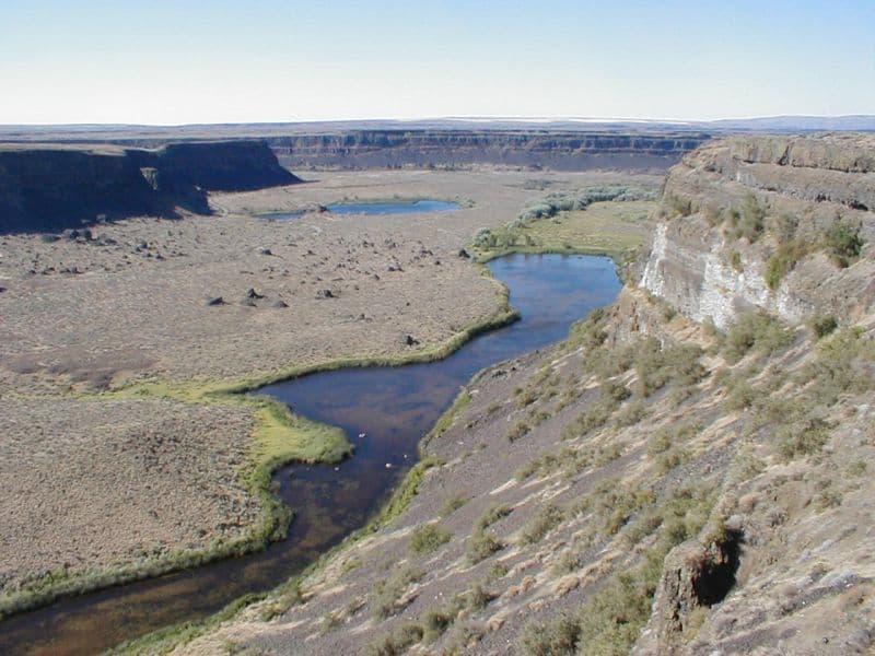
Grand Coulee is an ancient, 60-mile-long river bed in Washington State, U.S., bisected by Dry Falls into the Upper and Lower Grand Coulee. This immense geological feature was primarily carved by catastrophic glacial floods originating from Glacial Lake Missoula during the Pleistocene epoch, a process that stripped away soil and carved deep canyons. Today, the Upper Grand Coulee serves as Banks Lake, a vital part of the Columbia Basin Project for irrigation and recreation.

Lava Canyon
Lava Canyon is a striking geological feature located on the Chilko River in British Columbia, Canada. It is characterized by its impressive columnar basalt cliffs, a direct result of past volcanic activity in the region. The canyon plays a role in the natural landscape of the Chilcotin District, situated downstream from Chilko Lake.

Moses Coulee
Moses Coulee is a significant canyon located in the Waterville Plateau region of Douglas County, Washington. It is the second-largest and westernmost canyon of the Channeled Scablands, believed to have been carved by immense glacial outburst floods during past ice ages, with discharges exceeding 600,000 m3/s. The coulee's formation is attributed to glacial meltwaters, though the precise origins and age of these floods remain debated among researchers, with theories pointing to floods from glacial Lake Missoula or subglacial floods from the Okanogan Lobe.