
Sarakina Gorge
River Canyon·Greece·Kriopotamos River
Sarakina Gorge, also known as Myrtos Canyon, is a natural gorge located in southeastern Crete, Greece, near the village of Mithi. Carved by the Kriopotamos River, it features impressive walls reaching up to 150 meters in height and a varying width, with sections as narrow as 3 meters. The gorge offers a moderately challenging hiking experience due to its rocky terrain and the need to walk in the riverbed, making it a destination for adventurous visitors.
Key Facts
- ›Length is approximately 1.5 km.
- ›Width ranges between 3 and 10 meters, with some wider points.
- ›Wall height reaches a maximum of approximately 150 meters.
- ›The Kriopotamos River flows through the gorge.
- ›Transit time for a full traversal is about 1.5 hours.
- ›Difficulty level is considered medium, without requiring climbing equipment.
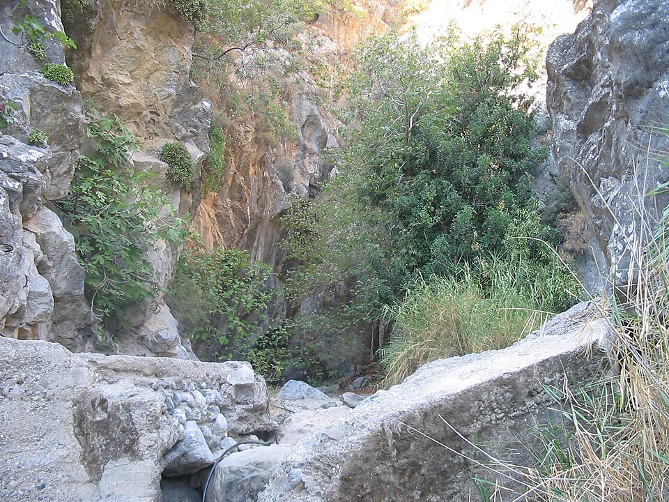
Myrtos Canyon
River Erosion
High Canyon Walls, Riverbed Walking Sections, Stone Steps
About Sarakina Gorge
Sarakina Gorge, also referred to as Myrtos Canyon, is a striking natural gorge located in the southeastern region of Crete, Greece. Situated a few kilometers inland from the coastal village of Myrtos and approximately 15 km west of Ierapetra, near the small village of Mithi, it presents a compelling landscape carved by the Kriopotamos River.
Geological Features
The gorge extends for about 1.5 kilometers, with its walls reaching an impressive height of up to approximately 150 meters. The width of the canyon varies considerably, typically ranging between 3 and 10 meters, though it narrows significantly in certain sections. The Kriopotamos River flows through Sarakina Gorge, its water levels fluctuating throughout the year due to the Mediterranean climate, characterized by moist winters and arid summers.
Access and Experience
While not yet developed as a major tourist destination, Sarakina Gorge offers access from both its lower and upper ends. The entrance to the gorge can be difficult to locate from either approach. The transit through the canyon is considered to be of medium difficulty, with a single traversal taking around 1.5 hours. Hikers must be prepared to walk in the riverbed and scramble over a few stone steps. However, the journey does not necessitate the use of climbing equipment.
Nearby Locations
Sarakina Gorge is part of a region in Crete known for its natural beauty and geological formations. Other notable gorges in the vicinity, which highlight the diverse topography of the island, include Richtis Gorge, Samaria Gorge, Ha Gorge, and Imbros Gorge. The region is also in proximity to the Dikti Mountains and the town of Ierapetra.
Source: Wikipedia ↗
Frequently Asked Questions
Where is Sarakina Gorge located?
Sarakina Gorge is situated in the southeastern part of Crete, Greece. It is found approximately 15 km west of Ierapetra and a few kilometers inland from Myrtos, close to the small village of Mithi.
What is the length and depth of Sarakina Gorge?
The gorge has a length of about 1.5 km. Its walls reach a peak height of approximately 150 meters, though the exact depth of the gorge floor varies.
What river flows through Sarakina Gorge?
The Kriopotamos River is the watercourse that flows through Sarakina Gorge. The water level in the river can vary throughout the year due to Crete's climate, with wetter winters and drier summers.
How difficult is it to hike through Sarakina Gorge?
The transit through Sarakina Gorge is rated as medium difficulty. While a full traversal takes about 1.5 hours, it involves walking in the riverbed in some sections and scrambling over stone steps, but does not require specialized climbing equipment.
How can I access Sarakina Gorge?
Sarakina Gorge can be accessed from both its lower and upper ends. However, finding the entrance can be challenging as the gorge has not been developed for mass tourism, making it less accessible.
Related Canyons

Agia Eirini Gorge
Agia Eirini Gorge is a scenic canyon located in southwestern Crete, Greece, renowned for its natural beauty and historical significance. Stretching 7.5 kilometers from the village of Agia Eirini to the coastal village of Sougia, it features steep mountain cliffs and forested areas. The gorge played a role in history, notably as an escape route for civilians during Ottoman rule.
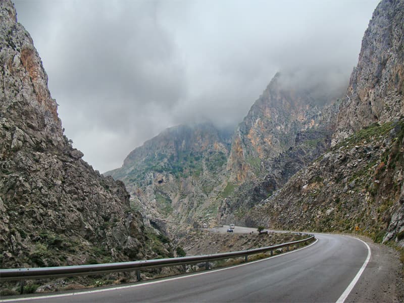
Kourtaliotiko Gorge
Kourtaliotiko Gorge, also known as Asomatos Gorge, is a significant natural feature on the southern side of western Crete, Greece. Carved by the Kourtaliotiko River flowing between the Kouroupa and Xiron mountains, it is renowned for its unique wind-generated "claps" and leads to the famous Preveli beach. The gorge serves as a vital habitat for wildlife, including the Lammergeier vulture, and is a popular destination for hikers.

Richtis Gorge
Richtis Gorge is a state-protected park in eastern Crete, Greece, known for its diverse hiking experience. The gorge, formed by natural erosion, stretches approximately 4 km from the village of Exo Mouliana to Richtis beach, featuring rich vegetation, historical stone bridges, water mills, and culminating in the Richtis Waterfall.